Quantcast
Channel: APAAME - Finding the past frame by frame
Viewing all 125 articles
Browse latest View live

Free Lecture: Roman Archaeology Group of Perth

$
0
0
Upcoming free lectures run by the Roman Archaeology Group of Perth:

2 Illustrated Lectures

Baths and Bathing in the Roman World
Dr. Sandra Ottley

2012 field trip to Jarash, Jordan
Don Boyer

Saturday 25 August
1:30pm
Social Sciences Lecture Theatre
University of Western Australia

1:30pm - Baths and Bathing in the Roman World
2:30pm - tea break ($7 for RAG Members $10 for non-members)
3:00pm - Annual General Meeting, Roman Archaeology Group of Perth, Inc.
3:30pm - 2012 field trip to Jarash, Jordan

Please let us know of your interest by emailing Norah Cooper (please see flier below).
Next lecture: Summer Lecture Series program coming soon!

To learn more about the Roman Archaeology Group of Perth please visit their webpage.


APAAME in the Biblical Archaeological Review

$
0
0
Picture
Machaerus. APAAME_20060910_DLK-0005. Photographer: David L. Kennedy
Győző Vörös' article in the Biblical Archaeological Review this month explains some fantastic progress since 2009 at the site of Machaerus in Jordan being conducted by the Hungarian Academy of Arts, in collaboration with the Jordanian Department of Antiquities. The article features some of APAAME's images from the region of Machaerus, as well as some stunning shots by Jane Taylor. You can find the article here: Machaerus: Where Salome Danced and John the Baptist Was Beheaded.
If you would like to see more images of the site of Machaerus, please visit our Flickr Archive.

Guest blog: Gary Rollefson and the Eastern Desert of Jordan

$
0
0
Research in the Eastern Desert of Jordan
2011 and 2012 
Prof. Garry Rollefson, Whitman College
Man made structures in the vicinity of Wisad Pools. Structure W-66 indicated. APAAME_20080909_DLK-0361. Photographer: David L Kennedy. Click to enlarge.
In 2007, when Alex Wasse and I revisited Wisad Pools in Jordan’s panhandle, we were stunned at the density of man-made structures at what appeared to be an enormous necropolis situated around a number of natural pools in a short wadi that collected rainfall during the rainy season. In the same summer we visited M-4 (“Maitland’s Mesa”) in the Wadi al-Qattafi, where there were clear pastoral structures on the top of this mesa as well as a tower tomb and a string of more than 50 rectilinear chambers extending from it along the southern edge of the mesa. In addition, there were numerous structures along the southern, western, and northern slopes, several of which showed striking parallels with nawamis tombs that had been reported from the Sinai and Yemen deserts. Since these two sites are currently characterized by hyperarid climatic condition, conventional wisdom and our own inclinations considered all of the basalt structures to be ritual in nature due to the effort necessary to construct them and to the ephemeral nature of most pastoral architecture. In our mind, these structures were permanent monuments to the dead, whether tumuli or cenotaphs. This interpretation proved to be incorrect, and although there are clear ritual structures at Wadi al-Qattafi and at Wisad Pools, many of the permanent structures are, in fact, domestic dwellings that imply some degree of permanence in occupation.

Structure W-66. Photograph courtesy of Gary Rollefson.
In 2011 Yorke Rowan, Megan Perry and I excavated several structures at Wisad Pools. Tower Tomb W-110 was clearly used as a burial structure, at least by Safaitic peoples (at least three individuals – male, female, and child – were recovered). Our focus was on a smaller structure (W-66), which we had thought was a collapsed small tower tomb. Not so. The excavation revealed that it was a permanent house (albeit probably occupied only during good rainy seasons and the following spring months), including gypsum plastered floors and a special alcove (also plastered, four times). More than 30 arrowheads of specific styles allowed us to date the house to between 6,500-6,000 BC, although C-14 samples are currently being assessed.
Bird's eye view of excavated structure SS-11. Photograph courtesy of Gary Rollefson.

Corbeled dwellings in the vicinity of SS-11.
APAAME_20080909_DLK-0271.
Photographer: David L. Kennedy. Click to enlarge.
The 2012 season of research at M-4 proved to be just as rectifying in terms of our original assumptions. SS-11 is an ovoid structure of 3.5 x 2.5 m that – before excavation – displayed a low doorway facing to the southwest, a clear parallel with nawamis in the Sinai and Yemen. (As it turned out, excavation revealed three doorways: to the east into a courtyard, to the south, and to the southwest). The roof of SS-11 had collapsed, and there was no indication of looting of the structure, which promised an unambiguous idea of what the building represented. The building, in fact, was another dwelling dating to 6,600-6,000 BC. In fact, once we realized the nature of SS-11, we could immediately identify a minimum of 6 other corbeled dwellings, all within a radius of 30-40 meters. Based on these results, and combined with our 2009 and 2010 GPS survey data that complemented APAAME photographs, it is now obvious that there were several pastoral families relying on hunting for their sustenance.

Frontal view of structure SS-11. Photograph courtesy of Gary Rollefson.

What the 2011 season and the one from 2012 indicate, there is no doubt that the bleak and barren landscapes that Google Earth and APAAME depict were not the case for the 7th millennium BC. It is possible that many of the small buildings at the feet of the northern and southern slopes of M-4, as well as the space between M5 and M-7, may in fact constitute small and even medium-sized semi-permanent Late Neolithic villages. Soils in the region during the Late Neolithic occupations were capable of absorbing and storing winter rainfall, resulting in more luxurious seasonal pasturage for sheep and goat herds. But it was the persistent overgrazing of increasing herd sizes of sheep that eventually exposed the soils to wind deflation, creating the forbidding landscape we see today. When did this tipping point occur? More excavation will provide some of the answers.
Wider landscape showing potential small buildings at the feet of M-4, M-5 and M-7; a possible Late Neolithic village. APAAME_20081102_DLK-0241. Photographer: David L. Kennedy. Click to enlarge.

Dr. Gary Rollefson is Professor of Anthropology at Whitman College, Walla Walla in the United States, specialising in Near Eastern prehistoric archaeology. He has worked collaboratively with colleagues from around the world on prehistoric sites in Jordan, including 'Ain Soda, 'Ain Ghazal, Wadi Rum, and now in the eastern desert of Jordan.

Publications: Kites–new discoveries and a new type

$
0
0
The discovery of an unusual specimen of kite with a limited distribution between Palmyra and Damascus in Syria led to the formulation of this journal article by David L. Kennedy.


Arabian Archaeology and Epigraphy (AAE) cover image

David L. Kennedy (2012) 'Kites–new discoveries and a new type', Arabian Archaeology and Epigraphy 23.2:145-155. You can find it at Wiley Online Library.


The 'sock' kite, fondly at first referred to as a 'Hockey Stick' kite, then (as we were feeling seasonal) a 'Christmas stocking' kite, with its narrow elongated 'shaft' and 'head' off to one side, forms the basis of this article. The discussion encompasses the form, distribution and geography of the new Kite type.

We also cover the extent of our current research on Kites in Arabia, and the article is generously accompanied by useful maps and distribution diagrams of Syria, Jordan and Saudi Arabia, and diagrams of the new Kite type.

Workshop - GIS and Near Eastern Archaeology

$
0
0

A Methodology for the Future? The role of GIS technologies within 21st century Near Eastern Archaeology

CBRL November 30th to December 2nd 2012 at the CBRL Institute in Amman, Jordan.


Congratulations to all the organisers of this intimate, perfectly formed workshop as it brought together a small but interested (and interesting) grouping.
An interesting group of workshop attendees - British Institute Director Carol Palmer (front far right); workshop organiser Jennie Bradbury of Durham University (front left of middle); and the author of this blog Bob Bewley (front centre) (Photograph: BI Amman Facebook page).
There were 22 people from wide range of places and backgrounds – a small group but a very useful event for two reasons. The first is the opportunity to share ideas, understand each other’s needs and work on ways of better and more useful collaboration.  For the APAAME project this will involve a closer working relationship between the MEGA-J (national online archaeological database for Jordan) and ourselves.

The second was a more general one of meeting and talking to people who one either wanted to talk to but never managed to find the time, or people one didn’t know and was glad to meet. The ‘regional’ nature of the archaeology was highlighted by the use of GIS – showing the longer terms trends when the masses of data are analysed to show the changing distribution patterns; be it in the prehistoric Roman or medieval periods.

One common theme kept emerging – which was that the threat to the archaeological sites and landscapes is huge; from a variety of agencies – farming, road building, town and village expansions as well the larger infrastructure projects (dams etc). Therefore there is a responsibility on us all to ensure that the information and knowledge we do have is made available to all those who need it – and they need it now.

We discussed so many challenges relating to databases and information management, which have been familiar to me in my working life and which are a reality in the Middle East.  The solutions may be simpler now, with much better internet access than ever before and the lessons learned from previous attempts at standardisation and consistency of recording.

This was also the best-fed workshop I have ever been too – apart from the excellent meals the rumour was that a certain person had ordered 10 kilos of baklava (various assorted types and sizes) but what amazed me was just how quickly it seemed to disappear (but then Bill Finlayson was there).   I regret to say I missed Bill’s summing up on the final day.

Finally it is also humbling to be reminded of the knowledge, skill and diversity of archaeologists; there was a French-Jordanian who was born in Italy, (has a French mother, a Palestinian-Jordanian father) who speaks Italian, French, Arabic and English. An architect turned archaeologist – Palestinian with a Russian mother and Palestinian father – who speaks Russian, English, Hebrew, and German and finally a French-Armenian who offered to give his talk in either Armenian, Russian or French; we chose French. 

Further photos can be found on the British Institute's facebook page.

Thank you Jennie Bradbury and Daniel Lawrence (Durham University), and the CBRL British Institute Amman team (Carole, Nadja and Firas) for organising and hosting an excellent event – when’s the follow up?

Bob Bewley
December 5th2012

Workshop Papers (in no particular order):
Wael Abu-Azizeh (CNRS, IFPO) 
  • New tools for Desert Archaeology: GIS/Database approach for a study of Pastoral Nomadic Campsites
Abdulsalam Almidani (Manager ICT Dept DGAM, Syria)  
  • Database and GIS systems applied in DGAM, Syria
Jennie Bradbury (PDRA, Durham University, CBRL Grant Holder)& Michael Brown (Visiting Research Fellow, CBRL)  
  • Online and Open Access GIS and Database Software and Resources
Robert Bewley (Aerial Photographic Archive for Archaeology in the Middle East)   
  • Aerial Archaeology in Jordan: sharing information
  • Google Earth, Fickr and the APAAME Project
Frank Braemer, Gourguen Davtian& Marion Rivoal (PaléoSyrien Project, CNRS)  
  • PaleoSYR: a cooperative project for a co-management of archaeological/historical data and environmental data
  • The PaleoSYR Database and GIS System
Bill Finlayson (Regional Director, CBRL) 
  • A Methodology for the Future? The role of GIS technologies within 21st century Near Eastern Archaeology
Mahmoud Hawari (Oriental Institute, University of Oxford)& Jana al-Araj (Birzeit University, Palestine)  
  • Hisham's Palace in Context: Archaeological Landscape Survey at the hinterland of Khirbat al-Mafjar, Jericho, Palestine
Ahmad Lash (Department of Antiquities, Jordan)  
  • Mega-J Database and the use of GIS in the Jordanian DoA
Daniel Lawrence (PaN and Fragile Crescent Project, Durham University)  
  • Approaching chronological issues at a broad scale: Examples from the Fragile Crescent Project
Bernd Müller-Neuhof (Deutsches Archäologisches Institut)  
  • Archaeology of the Jawa hinterland – a glimpse on the diversity of geoarchaeological applications in a project with regional approach
Paul Newson (American University of Beirut)  
  • Divergent Objectives, Integrated Outcomes: A GIS Case Study of the Bekaa Valley, Lebanon
Graham Philip (Vanishing Landscape Project, Durham University)  
  • Reconstructing Settlement Patterns: Combining Field and Satellite Data
Tony Wilkinson (PaN and Fragile Crescent Project, Durham University)  
  • The Fragile Crescent Project: Aims and Objectives
Jennie Bradbury& Daniel Lawrence (Durham University)  
  • The Fragile Crescent Database and GIS System

Publications - APAAME photo in December issue Antiquity

Publications- Bulletins

$
0
0

Bit of a catch up on some bulletins from the last few months:


Bob Bewley with David Kennedy, Mat Dalton & Rebecca Banks, 'Aerial Archaeology in Jordan: 2010-2012', Aerial Archaeology Research Group News, Vol. 45, September 2012: 74-81.
Available to members from their website.

Fiona Baker & David L. Kennedy 'Jarash Hinterland Survey' in: Keller, Porter & Tuttle, 'Newsletter: Archaeology in Jordan, 2010 and 2011 Seasons', American Journal of Archaeology, Vol. 116, No. 4, October 2012: 702-703.
Bulletin of the Council for British Research in the Levant logo
David Kennedy & Bob Bewley, 'The Harret al-Shaam, from Air and Space' in: 'Long-term Landscape Environment and Climate Change Studies, from the Past through to Predictive Models for  Future Developments', Bulletin of the Council for British Research in the Levant, Vol. 7, No. 1, October 2012: 60-62.
Available through IngentaConnect.

Publications - Historical Aerial Imagery in Jordan and the Wider Middle East


Slides of Syria

$
0
0
As the year comes to a close, it is inevitable that we reflect on what we have done and what has been happening in the world.

I have been scanning slides from the late 1970s… a lot of slides, of archaeological sites in the Middle East. Most were taken by David K at a time when sites were often in better condition or not yet overgrown by developing villages and towns, so archaeological artefacts in their own right.

While scanning these slides I continually came across evidence of the beautiful archaeological record of Syria, and in the news I daily come across reports of conflict that increasingly and unavoidably is affecting these archaeological sites, whether they are caught in the crossfire or directly targeted by looting.

So, I thought it best to share some of these digitised slides with you and take you to sites that we may not be able to protect now, or visit in the near future, but of which we can hope to preserve evidence and knowledge.

(In no particular order... Please click on an image to enlarge it.)
Basilica, Deir Semaan.
South west church, Deir Semaan.


Deir Semaan (Saint Symeon Monastery or Telanissos) is one of many ruined villages, known collectively as the 'Dead Cities' on the limestone massif west of Aleppo in Syria’s north. These late Roman villages are extraordinarily well preserved, buildings sometimes surviving to two and three stories high, and allowing a superb insight into late Roman town life. These magnificent ruins however have suffered in the crossfire, and also through looting. This short article on the research of Emma Cunliffe, Durham University, includes a witness’s video recording damage to one of these sites, and reports have emerged that the Monastery of Saint Symeon has been damaged by shelling. Link.
Temple of Nebo in foreground with the great temenos of the Temple of Bel in background, Palmyra.
Palmyra is one of the best-known ancient sites in Syria. The city flourished due to its profitable position between the west and east, and became a major Roman city in the 2nd and 3rd centuries AD. Built around an oasis in the middle of the desert, the grandeur and preservation of the site is all the more marked due to its isolation, and it has been a favourite of tourists since the 19th century. A report on the Global Heritage Fund blog details how the site has become caught in the crossfire and is a target for looting. http://globalheritagefund.org/onthewire/blog/palmyras_ruins.
West wall of Halebiyeh looking east from the citadel towards the Euphrates River.
Halebiyeh, or Zenobia, is located on the banks of the Euphrates. The walls extending out from the Citadel of an immense Late Roman fortress city are the most prominent feature of this beautifully preserved site. The astonishing scale and quality of preservation can be gauged by noting David’s white LWB Landover (inside of the city wall in the centre of picture) (cf. D. L. Kennedy and D. N. Riley, Rome’s Desert Frontier from the Air, London (Batsford)).

Section C3 of Dura Europos.
Palmyra gate, Dura Europos.


Dura Europos, also on the banks of the Euphrates River, was preserved in sand until its excavation during the interwar period, prompted by the discovery of remarkably preserved frescos. Even more important was the discovery of a huge cache of papyri which included the largest single collection of papyri for the Roman army anywhere in the Empire, including Egypt.
The Tetrapylon at Damascus, located at one end of Souk al-Hamidiyeh to the west of the Umayyad Mosque in the city centre.
Damascus is the ancient and modern capital of the region and where the archaeological record is hidden in side streets, built into houses, and walked through as part of daily life in a thriving city. As fighting intensifies closer to the ancient city (BBC news article: http://www.bbc.co.uk/news/magazine-20659573) how will the ancient walled city and 1400 year old Umayyad Mosque built over the immense church of St John fare if it breaks through to the heart? The once lively Souks and are now devoid of tourists and suffer from intensifying security raids. One hopes the beautiful Souk al-Hamidiyeh and the numerous early medieval houses tucked in side streets will not suffer the same fate as the ancient heritage listed market place of the city of Aleppo, the Souk al-Madina, which was irreparably damaged in September– see http://www.reuters.com/article/2012/09/30/us-syria-crisis-idUSBRE88J0X720120930
General view (north) of Bostra.
Bostra is in the south of Syria in a region known as the Hauran – a fertile semi-arid landscape on the edge of ancient lava-flows. It was the northern-most city of the Nabataean kingdom that stretched down through its capital at Petra into north-western Saudi Arabia. Nabataea was incorporated into the Roman Empire with Bostra as the capital of the new province of Arabia under Trajan in AD 106. The site is perhaps best known for its Roman theatre built from black basalt rock, but the ruins of the ancient city are also well preserved amongst the streets of the modern town, with towers in some cases standing over two stories high. The town has been damaged by shelling this year.

All photographs are © David L. Kennedy and belong to the Aerial Photographic Archive for Archaeology in the Middle East. After the slide collection is catalogued it will be available online at our Flickr archive: link.

I would like to thank David for looking over this blog, and for his continual remarks and encouragement while I develop the APAAME digital collection. Any remaining errors are wholly my own.
-Rebecca Banks 

Links:
Aryn Baker & Majdal Anjar, Syria’s Looted Past: how ancient artefacts are being traded for guns, Time World Sept 12 2012.
http://world.time.com/2012/09/12/syrias-looted-past-how-ancient-artifacts-are-being-traded-for-guns/
Emma Cunliffe’s updates on the Global Heritage Network blog site, one of the latest, which contains links to video footage, is the following:
Emma Cunliffe, No World Heritage Site Safe in Syria, Global Heritage Network Blog, Nov 19 2012.
http://globalheritagenetwork.ning.com/profiles/blogs/no-world-heritage-site-safe-in-syria#_edn16

Free Lecture - Roman Britain: Invasion and Conquest

$
0
0
Upcoming free lectures run by the Roman Archaeology Group of Perth:

2 Illustrated Lectures
Saturday 19 January
1:30pm
Fox Lecture Theatre
University of Western Australia
On Sunday 31 March the Roman Archaeology Group will have the pleasure of a lecture by one of the best-known experts on Roman Britain – Guy de la Bédoyère. As a prelude there will be four lectures establishing the circumstances in which many of the tribes of Britain were brought under Roman control and converted collectively into a new province – Britannia. The lectures will span the period from the expeditions by Julius Caesar in 55 and 54 BC to the high tide of conquest and the governor Julius Agricola, AD 77-84.

Invasion and Conquest
how the tribes of Britain were brought under Roman control
Winthrop Professor David Kennedy

1:30pm - Lecture 1: Caesar's expeditions of 55 and 54 BC
2:30pm - tea break ($7 for RAG Members $10 for non-members)
3:00pm - Lecture 2: The Invasion of the Emperor Claudius in AD 43

Please let us know of your interest by emailing Maire Gomes (please see flier below).
Next lectures: 2nd March

To learn more about the Roman Archaeology Group of Perth please visit their webpage.

Publications: Győző Vörös MACHAERUS I

$
0
0
Machaerus
Machaerus photographed by Robert Bewley.
(APAAME_20060910_RHB-0022)
Today we received a copy of Machaerus I. History, Archaeology and Architecture of the Fortified Herodian Royal Palace and City overlooking the Dead Sea in Transjordan by Győző Vörös. The volume is beautifully researched and illustrated, but we may be biased because the volume uses some APAAME images.

For more information on the volume, please visit the Edizioni Terra Santa website.

Slide Scanning - Samosata

$
0
0
We are currently digitising the APAAME slide collection of ground photographs, and I had the pleasure of completing the letter 'S' not that long ago.
'S' contained some beautiful sites in SYRIA, SABRATHA on the Mediterranean coast of Libya, and SARDIS in Turkey to name a few.
All of these sites are geoencoded in our database to allow for sites to be searched by location as well as by site name. When I was finding the geographical coordinates for SAMOSATA, I was surprised to come across this in Google Earth (having personally been unfamiliar with the site up until now).
Location of the ruins of Samosata beneath the Ataturk Dam in Turkey (click to enlarge).
Samosata, ancient city of Commagene, was flooded in 1991 with the construction of the Ataturk Dam, and the modern town of Samsat on the site was moved to the north on higher ground. The remains of the ancient tell, possibly the remains of a palace, can be seen here in the scanned slide, the photograph taken before construction of the dam. It had evidently become a playground for the local children of Samsat. The entire site is now at the bottom of Ataturk Dam.
Photograph taken on the tell of Samosata c1970s, the Euphrates River in the background. Photograph: David Kennedy (Click to enlarge).
Very little excavation occurred before the site was flooded. CORONA satellite imagery, freely available through the fantastic University of Arkansas' 'CORONA Atlas of the Middle East'reveals the extent of the ancient site - the walls c. five kilometers long, enclosing an area of roughly 200 hectares (500 acres). This ancient city was the capital of a prosperous Hellenistic kingdom that later flourished under the Roman Empire. This is evident when you provide some perspective: Samosata was roughly three times the size of Pompeii, and 50 percent larger than Londinium, the capital of Roman Britain (Kennedy 1998). Should excavations been carried out to a greater extent, finds may have revealed the wealth of the capital of the Commagene kingdom, its later prosperity under the Roman Empire and as home of the Legio XVI Flavia until the 3rd century AD before its gradual demise into obscurity.
Screen shot of Samosata from CORONA Atlas of the Middle East, University of Arkansas http://corona.cast.uark.edu/index.html#bbox=4282983,4509629,4292155,4514526
Due to the location of Samosata now under some 120m of water, these historical images are all that preserve the knowledge of the site for future generations - who may become keen Underwater Archaeologists to learn more of Samosata.

For more information on the site of Samosata and the flooding of archaeological sites by the construction of the Ataturk Dam: David L. Kennedy (1998) 'Drowned Cities of the Upper Euphrates', Saudi Aramco World 49.5 (Sept/Oct): http://www.saudiaramcoworld.com/issue/199805/drowned.cities.of.the.upper.euphrates.htm
To browse the CORONA imagery, please visit the CORONA Atlas of the Middle East: http://corona.cast.uark.edu/index.html

Historical Imagery - Berlin

$
0
0
As you may have noticed, we use Google Earth quite often to investigate ancient sites and how the landscape and site has changed in comparison with historical imagery.

Google Earth has a tool button that allows you to see historical imagery (if there is any) of an area  - in many cases the imagery dates can differ just a few years, but the changes can be drastic with urban expansion, natural disaster and other impacts vividly changing a landscape in just a short period of time.

You can view a period in the slightly more distant past over Berlin, Germany, a period that is particularly poignant to many people living today. Google Earth has extended its historical imagery for the site of the city of Berlin to two phases of aerial imagery during (1943/1945) and post World War Two (1953). The overlay appears to be made from a mosaic of aerial survey photographs, probably created by the United States Army Air Force (USAAF) and/or Royal Air Force (RAF), or aerial photographs confiscated from the German Air Ministry after WW2. For example, the United States National Archives Collection of Foreign Records Seized includes the following:

242.9.4 Other air force records
Aerial Photographs (8,000 items): Target dossiers of sites in Europe, North Africa, and the Middle East, with each dossier consisting of a map, an overprinted aerial photograph, and a site description, 1938-44; aerial photograph studies relating to specific types of targets in the United Kingdom, France, and the USSR, 1940-44; aerial mosaics of coastal areas in the United Kingdom and France, 1942-43; aerial prints and anaglyphs of central Italy, 1943-44; and aerial photographs of North African and Mediterranean sites, compiled for the German X Air Corps war diary, 1941-44. <http://www.archives.gov/research/guide-fed-records/groups/242.html>
These Aerial Photographs are linked to the records for Topographical Maps (242.25 Cartographic Records (General) (1910-18, 1935-45), and therefore probably include survey photographs.

Using the Historical Imagery tool you can change between the two phases and see the change from ruined buildings and bomb craters, to cleared land and some rebuilding.
Berlin 1953. Large parcels of city blocks of bombed ruins have been cleared. Image: Google Earth. Click to enlarge.
The capitals of London, Paris, Warsaw and Rome have also been overlain with historical aerial imagery. London and large areas of the south-east of Britain use one phase of imagery in 1945, Paris with two phases of 1943 and 1949, Warsaw with pre-WW2 imagery of 1935, and one of 1945, and Rome dating to 1943. Other smaller centers include Dortmund, Hanover, Leipzig, Cologne, Frankfurt, Wiesbaden, Koblenz, Nuremberg, Regensburg, Dresden, Wroclaw, Gdansk, Hamburg and Lubeck to name a few also have black and white historical imagery overlays.

Free Lecture - Time Team's Guy de la Bédoyère

$
0
0
The Roman Archaeology Group of Perth
Summer Lecture Series

Guest Presenter
Guy de la Bédoyère
Sunday 31st March 2013
Social Sciences Lecture Theatre, UWA (campus map)

Perth, Western Australia
1:30 pm
Well known for his appearances on BBC 4’s popular archaeology program TIME TEAM, ‘The Romans in Britain’ series by BBC 2 and 'The Open University',and his large volume of historical publications, Guy will be joining the Roman Archaeology Group for one lecture only to share his knowledge on Roman Britain.


LIGHT REFRESHMENTS WILL BE SERVED - $5 PER PERSON
Lecture is FREE but this event is TICKET-ONLY ADMISSION
To obtain your ticket CONTACT MAIRE on 9439 2828 ; gomescm@bigpond.com


Qatar Workshop in Aerial Archaeology - Zubara

$
0
0
The workshop participants.
In February this year Bob Bewley organised a Workshop in Aerial Archaeology hosted by the recently founded University College London campus in Qatar. (UCL-Q). The Workshop followed those held in Jordan in 2006 and 2008. This time the presenters were Bob (from UK), Wlodek Rączkowski from University of Poznan (Poland) and myself (UWA).

A component of a successful Workshop is to take the students to an archaeological site for which we have aerial photographs to enable them to see at first hand what the photographs add to knowledge and how they aid interpretation. In this case the site chosen was the 18th and 19th century Arab town of Zubara on the north coast of Qatar.
Aerial photograph of Zubara, Qatar. Thanks to Prof. Alan Walmsley for permission to use this aerial photo.
Zubara began life as a sheltered port for pearl-fishing in the Gulf but grew considerably as a port and processing centre for dates. At its peak it covered 60 ha – a long town with considerable traces of regular layout, several major buildings and a surrounding wall. Canals linked inland to a water source. Today it is completely deserted – apart from a team of archaeologists from University of Copenhagen. The latter are led by Prof. Alan Walmsley, a New Zealander who was a Post-Doctoral Fellow at UWA for two years and worked with me in Turkey at Zeugma.
Zubara, Qatar, viewed at ground level. Photo: David Kennedy.
At ground level the site is not very informative – many traces of protruding walls, the city wall, the trough of a canal …. From the air it looks superb and details emerge. Better still in many ways, the aerial view gives an immediate view of the entire site and its context in a way numerous ground photos will never do.

A fuller account of the Workshop can be found in Bob Bewley, David Kennedy & Wlodek Rączkowski 'Aerial Archaeology Workshop in Doha, Qatar: February 10th to 14th 2013', Aerial Archaeology Research Group News (AARGNews) 46 (March 2013): 15-18. The AARG website can be found HERE.

DLK

Back in Amman

$
0
0
Laying out the equipment ready for action.
The first of the team is starting to roll into Amman and setting up at the fantastic British Institute. The weather is a bit of a shock - from 33 degrees Celsius in Perth to a comparatively chilling 19 in Amman when we landed.
Having only visited Amman in the late Autumn before, when the landscape is drying out, the change in colour palate at this time of year is quite obvious as soon as you drop beneath the clouds coming into land with the tracks of wadis striking green against sandy soil.
Visibility was not too clear for the landing unfortunately. I thumping westerly wind has stirred up quite a bit of dust, but there has been a few spots of rain that has helped settle things to a relatively clear afternoon. Here is hoping the weather improves for us quick smart.

David Kennedy will be presenting at the BI Amman on Sunday 7 April at 6pm - for more information please visit the BI Amman website: http://www.bi-amman.org.uk/lectures.html

Works of the Old Men at British Institute, Amman

$
0
0
What a successful evening!

The last member of our team has arrived - we now number five with our fearless leaders David Kennedy and Robert (Bob) Bewley, assistants Mat Dalton and Rebecca Banks, and also our colleague and PhD candidate Don Boyer.
David begins his lecture at BIA, 7 April 2013.
Our evening was engagingly filled by a lecture hosted by the British Institute at Amman and conducted by David titled 'The Works of the Old Men', taken from Flight-Liutenant Maitland's 1927 Antiquity article of the same name. It is always fantastic to see friends' and colleagues' reactions to the photographs we take of the curious structures that span the Basalt Desert of the Harrat al-Shaam, knowing that we also are transfixed by them each time we fly.

Thank you to everyone that attended the evening and made it a huge success, not least to the British Institute, Amman - Carol, Firas, Nadja and staff who helped organise and run the evening, and for their continual support of the project. The supper put on afterwards was filling in both food and conversation.

Our first flight is tomorrow (Insha'Allah)! Look forward to sharing some photos with you.

Flight 20130409 – “The Longest day”

$
0
0
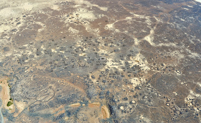
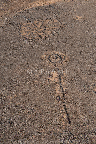
Bronze Age city of Jawa. © APAAME_20130409_DLK-0022.
Our first flying day of the 2013 season started well, with the No 8 Squadron Hueys back in action. We began our day with take off at 0710, headed east and successfully located the ancient (Bronze Age) city of Jawa, to record some recent activity there. Then it was on to a number of stunning locations in the black basalt desert.

However the story of the day was not what we achieved in the air, but what we didn’t achieve, as we were grounded for so long. Flying in the far east of the country requires re-fuelling at Ruweishid airbase, where the RJAF arrange for a fuel bowser to be there for us.

Dr Bernd Mueller-Neuhof relaxing before the day's flying.
After the first two-hour flight we re-fuelled without incident, and had another great flight recording a landscape of prehistoric flint mines. We were accompanied by Dr Bernd Müller-Neuhof, who has been surveying these on the ground. He pointed out the mines' exact locations– very useful as the outcrops looked rather geological to our untrained eyes. They are in fact one (of only two) very important sources of flint in the 4th millennium BC for the entire region.

On our return to Ruweishid to re-fuel again, a transport plane was on the runway (a C130, or Hercules). On disembarking there was more than the usual greeting party - how many people does it take to re-fuel an aircraft? On the first re-fuelling I counted 9; by now there was a dozen or more. There was animated discussion, all in Arabic, slightly away from the Huey, so I knew that something had changed. I wandered off to find a toilet and on returning found that the ‘animated party’ had departed, along with the pilot and David Kennedy. We were taken to the base commander’s office, where the animated party’s discussion continued. Coffee (strong local brew) and then some tea was served.

C130 at Ruweishid AFB.
Eventually it was explained to us that “our” bowser had taken on some contaminated fuel. The C-130 had been going to re-fuel (using “our” bowser) but to do so the bowser would have had to take on more fuel; this was available in a storage tank (which it transpired had not been used before), and the transfer began. However, upon inspection before re-fuelling the C-130 they discovered it was contaminated and so no one could use it.

So, what to do? Two aircraft: one (ours – the Huey) without enough fuel to take us anywhere, the other (the C130) with enough fuel to go anywhere, and a bowser with plenty of (contaminated) fuel. Many phone calls were made and option appraised, which resulted in the proposal to siphon fuel from the C-130 into jerrycans, and then transfer this fuel to the Huey.

So, how long does it take to siphon 700lbs of fuel from one aircraft to the other? A long time. Each jerrycan held 25lbs, and we needed 700lbs for a safe flight to Safawi (the nearest airbase with fuel). It transpired after about 2 hours of waiting (so, by this time c 1300 hrs) that each can was taking 15 minutes to fill. So 30 minutes per 100lbs, and we needed c 700lbs = 3.5 hours.

Lunch of rice and chicken was served – very welcome and enjoyable, even if (in the co-pilot’s own words) the chicken was ‘well done’. Hospitality is number one in Jordan – equal (on this day) to our safety.
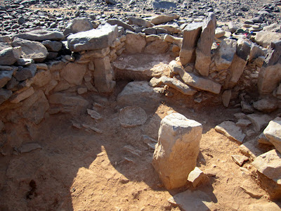
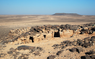
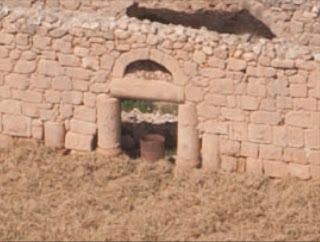
'Ghussein Settlement 2'. © APAAME_20130409_DLK-0041.
We continued to discuss our options. As the afternoon wore on the light was becoming better and better and there was one site in particular – Khirbet Abu al-Husayn – we wanted to photograph with Bernd. He and his team had discovered it in a field survey and no-one has yet photographed it from the air. It is not dissimilar to the site ‘Ghusein Settlement 2’ shown here. You can see why we were keen to get going!

After lunch we thought a 1600 departure would only allow time for a trip to Safawi to re-fuel and return to Amman before dark. Then, out of the blue we had a call to return to the aircraft; it was 1530. We noted the sign on the door as we left which read: “Last one out, turn off the television”…
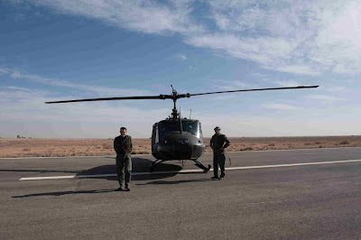
Bob Bewley and Pilot with a Huey from No. 8 Squadron.
Our hopes for photography raised by this scramble to get going were dashed when we saw that the re-fuelling was still ongoing and the pilot wanted three more cans to be loaded.
Quick re-calculation: hmmmm…won’t be airborne till 1630 and there’s a 20kt headwind. Might be dark when we get to Amman, even if we forget the idea of any further photography.
We filled this last hour with some ridiculous jokes and the differences between English and German humour. Bernd now knows a suite of “Knock, knock jokes”… none of which warrant repetition.

So, at 1650 (what’s another 20 minutes when you have waited 5 hours already?) we were strapped in ready to go; we lifted off at 1700 and arrived at Safawi 40 minutes later. A quick re-fuel and off; but remember hospitality is number one (as is safety), so we had ka’hawa (a welcome coffee) and then tea with the station commander. He seemed genuinely interested and we give him the website address for our photos and he gives us his card – a Brigadier-General! We don’t meet many of those, so we are glad to have accepted his hospitality. We started to ask ourselves 'what time does the sun set'?

Final leg: took off at 1815 and landed at Amman, safely, with the sun setting, at 1900. Officially the sun set at 1901.

I have been wondering about suggesting we do an afternoon flight, as we normally operate in the morning. At this time of year, there is scope for more, but circumstances today prevented from us taking full advantage.
Sunset over Amman at the end of the day.
 -Bob Bewley

Field trip 20130412 - Towards Tuba

$
0
0
Qasr et-Tuba. © APAAMEG_20130412_REB-0061.
Our first field trip of the season! It was a short jaunt down the Desert HWY on a beautiful moderate day to visit the sites of Khan es-Zabib, Qasr et-Tuba and some World War One trenches located next to the Hijaz Railway.

Something we found quite amusing was that for the more major sites of Khan es-Zabib and Qasr et-Tuba there were signs, but only at the preliminary turn off from the Desert HWY, and only if you were traveling north to Amman. In the case of Qasr et-Tuba, the sign was of little help as you have to turn off the road to a dirt track and drive a further 2 km or so - none of which is conveniently sign posted or easy to spot from the road.
A gouge taken out of the outer rooms of Khan es-Zabib. © APAAMEG_20130412_RHB-0005
Nonetheless, we made it to all sites. Khan es-Zabib is a Caravanserai located along the Hajj route to Mecca. Today, it is conveniently located right next to a road and well visible, some walls still standing well over a metre high. The Department of Antiquities have excavated the site and the clean backfilling of the surface of the site is evident by the lack of sherds of pottery lying around. There has been some interesting incursions into the site however with two gouging scoop marks clearly evident in the north and west outer rows of rooms, and numerous excavated holes over the site, one of which revealed sections of crude wall plastering. Walk further to the east, past the excavated church (only foundations) and the amount of surface pottery markedly increases, and some traces of walls are just evident on the surface. There is also a cistern in use. The site clearly is larger than the excavated Khan and Church areas and may warrant further investigation.
Cistern? near Khan es-Zabib. © APAAMEG_20130412_MND-0029.
To visit Qasr et-Tuba we continued south and then east. Located isolated along a wadi at the foot of a series of low hills, the location of this large Umayyad desert residence, or palace, is puzzling and majestic. From quite far off the vaulted ceiling of part of the complex is visible, a deep ruddy orange against the stark brown flint landscape. Low walls of earth have been erected around the site to protect it from heavy winter run off. The Qasr was never completed: the complete plan is evident in satellite imagery, but most of this must have never existed above foundations, only visible as low rises across the expanse of the site. Only about a quarter to a third of the site (if that) contains lower stone work and baked brick walls, only two rooms roofed with vaulted ceilings of baked brick. As you can see from the comparison of this RAF aerial image published by Creswell in volume 2 of 'Early Muslim Architecture' (1969) and one taken by us in 2009, the site has deteriorated. This was very evident on our visit, with the exposure to the elements of the lower courses of stone blocks causing the walls to disintegrate. However, there was evidence that the Department of Antiquities was carrying out restoration work to replace those stone blocks that had become untenable and threatening the integrity of the upper baked brick walls. Despite some graffiti, the site did not seem to be suffering from the unwanted attention of vandals, possibly kept safe by its isolation.
Comparison of the RAF image of Qasr et-Tuba and an aerial photograph taken by APAAME in 2009.
On our return drive from Qasr et-Tuba, we investigated north and south of the Hijaz Railway crossing. Here there are located a few bridges, and on the hills above them are World War One trenches, once positioned to defend them. The Railway itself is a magnificent artefact - the railway tracks still have legibly cast upon their surface the manufacturing locations - Maryland, U.S.A., the sleepers: Ougree, Belgium (1903 and 1904 for the section we observed). The trenches range from small circular affairs on the summit of hills (giving us our exercise for the day!), to longer networks of trenches. Should you be interested in these sites, The Great Arab Revolt Project (GARP) is worth a look.
Section of the Hijaz Railway with two bridges as seen from a small circuit of WW1 trenches ©APAAMEG_20130412_DLK-0072.
On our return into Amman, we stopped briefly at Tell Umeiri which is cut by the Highway. We visited the East summit where a Church has been excavated. The mosaic floor had been covered in plastic, then reburied under sand, but unfortunately curiosity has gotten the better of some visitors and the plastic was ripped revealing sections of mosaic, some damaged extensively. As it was a Friday, there were also numerous Jordanians out on the lush Spring grass of the Tell for a picnic- a beautiful spot above the hub of the city's busy roads.
Tell Umeiri East Church. © APAAMEG_20130412_RHB-0086.
All photographs from our field trips will be made available on our Flickr site. They are referenced as 'APAAMEG'.

Flight 20130414 - Finding El-Mushaggar

$
0
0
El-Mushaggar. © APAAME_20130414_DLK-0191.
We took pictures of this village because there were old reports it had once had archaeological remains. All we could see was this roofless relatively modern building in the middle of the current cemetery. But if you zoom in on the doorway you see it consists of two reused ancient columns with some column stumps in the wall nearby.
Close up of the re-used columns.
 -DLK
Viewing all 125 articles
Browse latest View live