Quantcast
Channel: APAAME - Finding the past frame by frame
Viewing all 125 articles
Browse latest View live

Publications (Correction): Pioneers Above Jordan

$
0
0
It has just come to our attention that the article
David Kennedy 2012 'Pioneers Above Jordan: revealing a prehistoric landscape', Antiquity 86 (332): 474-491.
contains an error for the image and caption of figure 10.

The image in the text is the following:
Ausaji Kite 28
Ausaji Kite 28. Photographer: David Kennedy (APAAME_20091008_DLK-0167).
The caption should identify the site as 'Ausaji Kite 28'.

The caption in the published text is that for the following image:
Wisad Kite 14
Wisad Kite 14. Photographer: Robert Bewley (APAAME_20091004_RHB-0073).
The caption from the article reads as follows:
Wisad Kite 14 (APAAME 20091004 RHB-0073). A kite surrounded by an immense tangle of walls, few of them visible at ground level. In the top left is the Wisad Police Post on the Airmail Track.

Preflight work flow – AAJ May 2016

$
0
0
Our bags are packed, flights booked and we’ll be landing in Amman soon for this our 20th year of flying in Jordan (the first season was way back in 1997)!

This May will see a short series of flights, hopefully three in total – one to the north and along the Jordan Valley, one to the East into the Badia, and one to the south concentrating on the fertile Kerak Plateau.

We will also be attending the International Conference of the History and Archaeology of Jordan and look forward to seeing excellent presentations on the projects and research occurring. You can find the program on the conference website http://ichaj.org/

See you in the air!

Kh. el-Musheirfeh and MEGA-Jordan

$
0
0
The Jordanian village of Kh. el-Musheirfeh lies about 4 km southwest of the major Nabataean/ Roman/ Early Islamic village/ fort/ town of Umm er-Resas. A further 4 km south is the major archaeological site of Lehun on the rim of the great trough of the Wadi Mujib.

The published literature on the site is limited and the two entries in JADIS and now in MEGA-Jordan are confused, confusing and incomplete.

‘MEGA-J 12338 Musheirifa (sic)’ locates a ‘site’ on the south side of the modern village but that turns out to be only the modern village itself.

‘MEGA-J 12349 Musheirfeh (sic)’ is located 2.5 km to the northeast of the village but in an open area with no traces of any archaeological features.

Surprisingly, therefore, the record reports material of several periods - Nabataean, Roman, Byzantine, Islamic, Modern, and lists eight ‘Site Elements’ including a village, cistern, a bas relief and sherd scatters of the periods noted. The source of the information is given in two published references from the 1930s (Glueck and Savignac, below). A brief glance at these two publications confirms the obvious – there is just one site and it lies under and around the modern village. The second MEGA-J entry (12349) should be deleted and the information there should be transferred to the first entry (12338) under that spelling (as on the 1:50,000 map).

Musheirfeh is in fact an important site as the two published reports show. Glueck was there on 2 June 1933; Savignac in late April 1935. The latter knows of Glueck’s first major report on his survey which included this site but – inexplicably, does not refer to what he had published. i.e. the two reports are effectively independent of one another. Putting the two reports together allows a composite picture which can be considerably enhanced and developed by analysis of the satellite imagery on Google Earth and Bing, by interpretation of the survey aerial photographs of 1953 and the recent low-level aerial photographs taken by the Aerial Archaeology in Jordan project, all of which are in the APAAME archive.


As may be seen on Google Earth (https://goo.gl/maps/EtATHBHTrdN2) and the superior imagery on Bing (http://binged.it/1DKqghT), amidst the houses the site consists of an area of high ground with traces of:
  • buried structures,
  • the openings of cisterns,
  • the foundations of a large masonry building extending eastwards
  • a further significant structure to the west.
The remains cover an area of about 10 ha though much of it was probably open ground between a scatter of structures and occupied by cisterns. Several recent cemeteries are scattered around the village. The major modern structure recorded by Glueck and Savignac is on the south side, marked as ‘Summit’ (Fig. 2).

This modern building (Summit) seen by Savignac and Glueck was built from re-used masonry and included a significant fragment of anthropomorphic sculpture and a substantial architectural piece (Fig. 1). As it was on a ‘sommet’, it may well be overlying an earlier structure (Fig. 3). More significant is the substantial building on the eastern end of the site (B) not reported by either early traveller (Figs 2 and 3). It is c. 25 x 15 m and oriented east-west. As seen from the air in 2010 and 2015, it has been robbed to a low level but the form is clear. There are at least two other places where traces of walls can be seen in this East Range (Fig. 7). West of the ‘Summit’ a further structure seems hinted at by a rectangular outline (C) (Fig. 6).

The sculpture was identified as Nabataean and there was Nabataean pottery on the site. Such an object implies a religious structure of some kind and more than a simple shrine. Glueck thought the architectural lintel he illustrated might be Byzantine – though he compared it to one he had seen at Umm el-Walid which is largely Umayyad.

Figure 1: Relief sculpture and lintel seen on the site in the 1930s by both Savignac and Glueck (1934: 38 Fig. 16)
The 1953 vertical survey aerial photographs show just one modern building there at that date and otherwise allow the broad outline of disturbance to be defined but without specific detail.

The satellite imagery indicates where structures lie but are recent (since the modern village expanded), are inadequate for detail but offer a useful photomap (cf. Fig.2).

Figure 2: Kh. el-Musheirfeh on Google Earth. Red outlines the overall area within which structures are located. Blue is a range of buildings, traces of building and probable cisterns. Other features noted are treated in subsequent figures (below) (Click to enlarge figure).

More importantly, there are 54 low-level oblique aerial photographs of the site in the APAAME collection from April 2010 and October 2015. Between them they reveal the presence of two substantial masonry buildings (A and C) which can be located and their form established, at least one more possible building (B), structures with re-used masonry (e.g. ‘Enclosure’) and the location of several cisterns (‘East Range’).

Summit’ and Enclosure (Fig. 3). This area of high ground is the probable location of what Savignac called the ‘sommet’ and where he and Glueck saw the architectural piece and the statue fragment. Today it is used as a small cemetery and the eastern half appears to have been quarried away. The enclosure on the west (bottom) seems to be formed from re-used masonry and arranged as a double face all of it surrounding a significant depression. The latter may be a dry reservoir, the ‘Bir Akial Awad’ recorded there on the 1:50,000 map.

Figure 3: Kh. el-Musheirfeh Summit and Enclosure (APAAME_20151005_REB-0008).
Building A (Fig. 4). A rectangular building located on the west side of the modern village. Approximate dimensions: 30 x 20 m. A square room is visible in the northeast corner (bottom left).

Figure 4: Kh. el-Musheirfeh Building A (APAAME_20151005_REB-0012(Cropped).
Building C (Fig. 5). Located at the eastern end of the East Range. It is the best-preserved of the various structures, with substantial walls with faced masonry inside and out and several rooms visible. The curving wall on the left may be part of an apse but the internal arrangements of the walls do not seem suited to a church. Overall dimensions are c. 35 x 20 m. Stones used in the modern graves are probably taken from this building.

Figure 5: Kh. el-Musheirfeh Building C (APAAME_20151005_MND-0031(Cropped).
Building B (Fig. 6). Located just west of Building C. It appears as an almost square structure incorporating a cavern on the right (north). It is c. 20 x 20 m.

Figure 6: Kh. el-Musheirfeh Building C (APAAME_20151005_REB-0014 (Cropped)).
East Range (Fig. 7). In addition to Buildings B (right) and C (centre), there are traces of other foundations including in the courtyards of the modern houses at the west end of the range. Depressions and caverns may be collapsed cisterns.

Figure 7: Kh. el-Musheirfeh East Range (APAAME_20151005_DLK-0013(Cropped)).

Conclusion
The MEGA-J entries for Musheirfeh are defective and limited in usefulness. At an elementary level – as with all MEGA-J entries, it would be immensely useful if references provided precise page numbers rather than just – for example, Savignac 1936. Many entries are taken over unchecked from JADIS and contain errors or errors are introduced in the transfer. Many entries would benefit from a reminder - and a specific link, that there may be aerial photographs available in the Aerial Photographic Archive for Archaeology in the Middle East (APAAME).

– David Kennedy

APAAME (https://www.flickr.com/photos/apaame/collections).
Glueck, N. (1934) Explorations in Eastern Palestine, I, New Haven (AASOR XIV [1933-1934]: 1-113 at 37-8 (Site 95) and Fig. 16.
Savignac, R. (1936) “Chronique: Sur les pistes de Transjordanie méridionale”, RB45: 235-263 + Plates VII –XII at 242-3 and Pl. VIII.1.

FL20160523 - Clouds in the North

$
0
0
The Aerial Archaeology in Jordan project has just begun its 20th season (after David’s flight in 1997) and it coincides with ICHAJ13- a conference to celebrate and be informed of recent archaeological work in Jordan. Balancing the commitments of the conference with trying to fly was always going to be tricky but the opportunity to undertake aerial surveys should never be missed, especially in this region.

Jordan Valley; Tabaqat Fahl
Jordan Valley near Pella. Low cloud made visibility and photography not ideal. Photographer: Robert Bewley. APAAME_20160523_RHB-0219.

Jordan never ceases to surprise, and this year has seen the demise of the Air Force’s Huey helicopters, which we had come to love – despite their the noise, and discomfort too, but also great space and views with the door open, and relatively slow speed. So, this first fight (Andrea Zerbini and I) was also experimental in learning the art of aerial photography in a new machine – the Eurocopter (or EC 635).


With 3 of its seats taken out the two of us were able to sit side-by-side at the open door, with similar panoramas as the Huey, but a quieter, smoother ride. Sadly the weather was not great; cloudy and cold and we were heading north, so less likely for a clearance in the weather. However we photographed most of the targets, only missing the last sector because of the cloud. We were with a new squadron, so the pilots were also new to our work, but they (as ever) provided us with top-notch flying. The internal communication system also is an improvement on the intermittent service we used to get; this makes the “strike rate” of targets photographed per hour much better as we can communicate the move to every new location clearly (and the EC is also faster, having two engines – so safer too).

The flight started in the region of Jarash photographing structures identified by PhD candidate Don Boyer for the Jarash Water Project, and also to catch a glimpse of the East Baths that are currently being excavated by a French-German Mission with the Department of Antiquities and recently yielded this magnificent statue. The flight then progressed over the Ajlun highlands to focus on wadi systems that empty west into the Jordan Valley. This fertile region saw settlement over millennia and the concentration of sites, such as tells and low level ruins, was vast. Many sites were previously unphotographed, while others we monitored to assess change over time, such as at Pella/Tabaqat Fahl. Unfortunately, a few sites showed evidence of looting.

Hammeh Cemetery
The looted cemetery at Hammeh. Photographer: Robert Bewley. APAAME_20160523_RHB-0216.
The discovery of sites which have not been previously recorded also gives us the desire to carry on; we spotted a site in passing and photographed it. Becc tells us it is not in MEGA-J, and a reasonably substantial site, rectilinear stone structures, in a prominent location. One for further investigation and adding to the EAMENA and MEGA-J databases.

Deir Abu Said Ruin 13
Unidentified site near Pella. Photographer: Andrea Zerbini. APAAME_20160523_AZ-0170.
We were in time to return to the conference, where the (royal) opening ceremony had just taken place and everyone was milling about having coffee. This gave the opportunity for many of the participants to thank us for the use of the aerial images from the APAAME website, and responding to their specific request for new imagery. Knowing the material is being used and is making a contribution to archaeological research gives us the stimulus and motivation to continue. One colleague said our images were able to “stop traffic”, a reference to people seeing an aerial photo on his screen as they were passing by his office, and would stop to ask what they were looking at.

Bob Bewley

You can find the images from Flight 1 on our Flickr: https://www.flickr.com/photos/apaame/albums/72157668878686805

Flight 20160526 - East into the Badia

$
0
0
The second flight of the 2016 season saw Becc and I heading east to the Azraq area, taking in Qasr Aseikhim, a wonderful and significant multi period hilltop site but which is suffering badly from the bulldozer as access roads make it more accessible.
Qasr Aseikhim showing signs of damage from bulldozing. Photographer: Rebecca Banks. APAAME_20160526_REB-0132.
We then headed to assess the impact of the construction of the Azraq by-pass on the stone built structures on the Harrat al-‘Uwaynid. It was truly depressing seeing what had been destroyed without thorough investigations (a presentation at ICHAJ13 by Romel Garib said a survey had been conducted with the help of Prof. Gary Rollefson, but no excavation); truly a missed opportunity as the area is rich in kite-sites, wheels, and pendants (one of which we have been monitoring and has had its tail smashed through – seemingly unnecessarily). These sites are representative of this part of the basalt plateau, and we know so little about them.


A pendant showing damage from tracks associated with the building of the Azraq by-pass over the Harrat al-'Uwaynid. Photographer: Rebecca Banks. APAAME_20160526_REB-0176.
There are archaeological teams from America, Britain, France, Germany, Holland, Jordan and Italy working in the basalt region in cooperation with the Department of Antiquities. These numerous teams are giving us a better insight into the date and function of many of the sites, and the migrating patterns of important species such as the gazelle. Results from all of these were being presented and discussed at the ICHAJ13, some of which we had to miss because of the flying. It is a pity more were not approached for a one-off collective “rescue archaeology” project, but unfortunately it sounds like the Department of Antiquities were brought into survey the site after the ink had dried on the plans. Better integration between infrastructure development planning and archaeological survey and the respective responsible departments is a must if this is not to be repeated in the future, which is something we are trying to achieve with the Endangered Archaeology in the Middle East and North Africa Project.

However our reconnaissance is part of the investigations. We assist a number of projects and it is only by the use of the helicopter that we can cover so much ground – from Azraq to Ruweishid and then back to the Wisad and Qattafi areas. Fortunately we have surveyed Harrat al-Uwaynid in the past and those photographs of sites provide somewhat of a legacy for future knowledge.

One of the excavated sites of the Jebel Qurma Project. Photographer: Rebecca Banks. APAAME_20160526_REB-0301.
From Harrat al-Uwaynid we progressed to the Jebel Qurma where Professor Akkermans’ team have been investigating the numerous sites, then onto the main section of the Harret al-Shaam where two projects, the Northern Badia Project under Bernd Müller-Neuhof and the Eastern Badia Project with Prof. Gary Rollefson are working. It was a long day, and much warmer than the first flight, with many targets close together and much orbiting – which all contributed to the demise of the “crew man” who was not well, on three separate occasions during the flight. I wondered about curtailing the mission but every time we landed and re-fuelled he seemed fine and happy to continue.

The green bed of a wadi system near the Bakhita area. Photograph: Rebecca Banks. APAAME_20160526_REB-0584.
The black basalt desert is one of the most striking and unique landscapes anywhere in the world and never ceases to impress; this year it was the light greenery in the some of the wadis providing a context for the archaeological sites and a welcome relief from the blackness.

Bakhita enclosures site around a water catchment area. Photographer: Robert Bewley. APAAME_20160526_RHB-0635. 
Highlights included dense structure activity grouped around water catchment areas – still holding water with the late Spring weather Jordan has been experiencing. One such area we had named as “Bakhita enclosures” – a natural depression (still with some water in it) surrounded by a variety of stone enclosures –of an unusual form, and with stone walls leading into the pool, perhaps part of a water catchment system? The enclosures may be remains of settlements or occupation evidence of the people, many thousands of years ago, who had found a perfect location for seasonal living.

Chain Wall site. Photographer: Robert Bewley. APAAME_20160526_RHB-0479.
Not all the sites are untouched and we saw many instances of the random use of the bulldozer, dissecting sites for no apparent reason, as not all the bulldozed tracks become roads. We did see good examples of the “chain-walls”, small stone built structures all linked together and forming an enclosed area, but for what purpose and by whom we have, as yet no idea.

Stein's site 'al-Qseir Ghadir'. Photographer: Rebecca Banks. APAAME_20160526_REB-0485.
One of the places we flew was originally photographed by Sir Aurel Stein in his reconnaissance of Transjordan in 1939. Becc has digitized these images (in cooperation with the British Academy) and this site, Al Qseir Ghadir, she was able to locate and schedule into our reconnaissance. Stein had visited on the ground but found no surface material to date it, likewise a more recent visit by colleague Bernd Müller-Neuhof, who considers it could be Early Bronze Age. It is interesting to see the change – some 77 years later. Becc presented the site along with other ‘forgotten’ sites from Stein’s aerial survey at the ICHAJ conference. It is evident stone robbing has occurred to build a corral nearby, and the built structures seem to have been damaged and reduced to incoherent rubble, but the outline of the water catchment area is still intact.

Rebecca Banks in action in the Eurocopter. Photographer: Robert Bewley. APAAME_20160526_RHB-0543.
It is always fun to take a “few “action shots” showing what it is like undertaking the photography and we were able to do so, too on this flight. We certainly had put the pilots through their paces (and the poor crew man), and after almost 6 hours we were ready for a break, so we finished the day with a quick final re-fuel at Azraq before the final leg to Marka in the relative comfort of a seat in the Eurocopter.

- Rebecca Banks and Robert Bewley.

FL20160529 - Low clouds over the Kerak Plateau

$
0
0
Aiming for a 7 o’clock take off we left CBRL at 0630, Andrea and I, with the sun rising and some clouds in the west. As we crossed the Hejaz railway en route to Marka we were overtaken by the Squadron Commander, who waved and we followed him; I was wondering which gate to the air base he’d use (as there is more than one). Every year we have gone through a ritual at the gate where the guards don’t have a clue who we are, despite assurances the previous day that the guards have been informed. Today we followed him through a gate we knew existed but have never used; this is the gate where we have been supposed to enter - the gate where the guards have been forewarned each day (by the squadron commanders) prior to arrival. As it was our last day of the season we will not know if we will have “cracked” the gate until September, when we hope to return.

The Madaba Martyrs Church, section of Roman Road and the 'Burnt Palace'. Photographer: Robert Bewley. APAAME_20160529_RHB-0017.

A different crew, our third, and we were airborne by 0705 but the clouds were not looking promising; we did targets around Madaba recording a section of the ancient city about to be sheltered as part of the Archaeological Park and pressed on – with occasional glimpses and one or two superb hilltop sites. However as the land rose there was no distance between it, us and the clouds – so we headed out of the clouds to the east. We had scheduled several sites on the Kerak Plateau and in the Jordan Valley, but these had to be left for September.
Hill top site of Jabal er-Ras. Photographer: Robert Bewley. APAAME_20160529_RHB-0088.
Hoping for a quick refuel, we reviewed the potential targets and decided to stay east where visibility was good, but there was a problem with the fuel bowser, so we decided a comfort break was a good idea – even went up the control tower, another first. The delay ended up being short and we managed to do all the scheduled sites in the Al-Hasa and Qatrana area looking at sites reported in the Limes Arabicus Survey.
Qasr Bshir. The inscription is located above the gate. Photographer: Robert Bewley. APAAME_20160529_RHB-0323
We also flew over Qasr Bshir – a first for Andrea and always a pleasure to see, especially when the light is good. I mentioned taking a view of the site in its landscape and the pilot said “you want to land?” and before waiting for answer we were down at tower height, and almost able to read the inscription above the main gate. Great site, though there are serious concerns about the stability of the walls and towers from cracking and masonry tumbles. If ever there is “endangered archaeology” this is it – not from any particular force or agent – just age and lack of maintenance. This is a site of very special importance in terms of its preservation, one of very few in the Roman Empire with such unique upstanding preservation. A tower to the north of the fort, Limes Arabicus Survey site 102, has been completely obliterated by stone robbing and possibly looting.
Ariha Tower 23
The tower (Ariha Tower 23/Limes Arabicus site 102) in 2009. Photographer: Michael Neville. APAAME_20090930_MJN-458.
The tower, now obliterated, in 2016. Photographer: Robert Bewley. APAAME_20160529_RHB-0325.
Our last site of the day was Rujm esh-Shid, a site photographed in Sir Aurel Stein’s 'Limes' Survey and located and flown just last year. Since then, however, the area has been heavily sampled for Uranium (see article: http://www.mdpi.com/2075-163X/5/2/133), and so it was important to photograph the site again to monitor impact. Unfortunately, this site is in an ever-worsening state and without intervention or proper investigation it will surely be lost.
The site of Rujm esh-Shid in foreground with the pits from Uranium sampling in the background. Photographer: Robert Bewley. APAAME_20160529_RHB-0358.
After seeing this site we headed back to Amman, unfortunately leaving the remaining scheduled sites in the west for another day with better flying conditions.

Overall, this short season has had three fascinating flights over a ten day period, 13.2 hours and a few thousand photographs, recording new material and a fast changing landscape. It is a privilege to be allowed to undertake such work and in the knowledge and expectation it will, one day, make a difference.

Bob Bewley

AAJ May 2016 - Highs, Lows, and Goodbyes to the Hueys

$
0
0
When we are in Jordan we will squeeze in any opportunity to fly, but this year it was particularly important to do a few flights as we have sadly lost the use of the wonderful beast of helicoptering - the Huey, and we had to test our new machines and pilots of the Eurocopters.
Jafr AFB
One of the RJAF Hueys in flight during the 2010 season. Photographer: Don Boyer. APAAME_20101016_DDB-0045.
The Huey has been our principal form of aerial reconnaissance since the Aerial Archaeology in Jordan project started in 1997. The advantages of the Huey were its spacious interior, large opening (once the door was open) and outward facing seats that allowed four photographers to operate together. Given these machines had been in operation during the Vietnam War (see our blog 'I Love the Smell of Nabataea in the Morning'), and one had a bullet hole to prove it, we knew we would have to move on eventually. They had their quirks, like the communication systems being flakey, shaking you about so that you could feel the movement for several hours after landing, and the noise! We felt a pang of grief for the loss of a trusted friend that had transported us over the varied sites and landscapes of Jordan. If anyone has a few million pounds to service a small fleet of Hueys for us, I am sure we could make good use of it!


Our old squadron, 8 Squadron (السرب الثامن) which flew the Hueys and with whom we have shared many fantastic years of flying has moved on too. We now are the passengers of 14 Squadron (السرب الرابع عشر) and their Eurocopter 635. The Eurocopter is a smaller but twin-engined aircraft but only two photographers can now attend any flight. This limits the ability to have a person acting purely in the role of 'spotter' as the others handle the navigation and communication with the pilots. The aircraft is primarily for transport, so the large and comfortable backward facing seats are removed. This gives room to allow us to sit on the floor facing out the door, legs braced against the landing skid, while our trusty crew member makes sure our body harnesses keep us safe and strapped into the aircraft. The speed, comfort, stability and quiet however are far superior to the Huey. The crewmen may beg to differ I am sure as on two occasions they have suffered airsickness from the constant circling required for us to photograph our target sites! I am sure you are all wondering why we do not upgrade to a Blackhawk, but it is probably too much of a beast for our aerial reconnaissance and burns through the fuel to match!
Photograph distribution of Aerial Archaeology in Jordan May 2016 flights. Imagery: Google Earth.
The other challenge for us this season was the unseasonably late spring that saw cloud interrupting two of our three flights. Cloud can be a problem for two main reasons - the first is visibility, both in terms of sites but also safety of navigation, and the second is the quality of the resulting images for analysis. Our first flight to the north suffered from very 'flat' light at first, then the last leg of the scheduled flight was abandoned altogether as the cloud lifted but did not clear causing harsh contrasts between sun and shade, and making photographing sites well all but impossible. The third flight had the majority of scheduled sites abandoned due to low cloud that made reconnaissance simply unsafe. These were over the Kerak plateau and into the Dead Sea valley where we were hoping to fly sites that had been requested and under current investigation by colleagues, but these will have to be left for September when we hope the skies will be clearer.
Tell Khirbet Um al-Ghozlan
Poor light at Khirbet Um al-Ghozlan obscures the site. Photographer: Robert Bewley. APAAME_20160523_RHB-0417. 

This season was once again, however, successful as the archaeology of Jordan never ceases to amaze. We completed 13.34 hours of flying, over three separate days, taking just over 2700 photographs of 487 features. We covered areas in the north, east and central areas of Jordan. Our reconnaissance team included Robert Bewley, Andrea Zerbini and Rebecca Banks. You can find the 2016 photographs on our Flickr: https://www.flickr.com/photos/apaame/collections/72157666359145684/Some choice examples from each of the flights are below.

Khirbat al-Dawayr
The excavated site of Khirbat al-Dawayr. Photographer: Andrea Zerbini. APAAME_20160523_AZ-0105. 

Deir Abu Said Ruin 13
As yet unidentified (by us) site near Pella. Photographer: Andrea Zerbini. APAAME_20160523_AZ-0170.
Azraq Enclosure 6; Azraq Wheel 290; Azraq Wheel 291; Azraq Wheel 292; Azraq Wheel 293
A linear arrangement of enclosures, or wheels, near Azraq. Photographer: Robert Bewley. APAAME_20160526_RHB-0065

Rajil Pendant 42
A pendant partially excavated. Photographer: Robert Bewley. APAAME_20160526_RHB-0254.

Ausaji Enclosures 6; Ausaji Enclosures 7; Ausaji Enclosures 8; Ausaji Wheel? 311; Ausaji Wall 31
Clusters of sites along a wadi in the Badia. Photographer: Rebecca Banks. APAAME_20160526_REB-0466

Aina Ruin 23
A well-preserved possibly Nabataean site. Photographer: Andrea Zerbini. APAAME_20160529_AZ-0082.
Ruweihi (= WHS 674); Aina Cemetery 1 (WHS 580))
The site of Ruweihi along the Wadi el-Hasa. Unfortunately looting is occurring in the vicinity of the site. Photographer: Andrea Zerbini. APAAME_20160529_AZ-0111.

Mutarammil Cave 2 (Limes Arabicus 315?); Mutarammil Temporary Camp 2 (Limes Arabicus 316); Quarry/Reservoir (W. Muqta'a (Limes Arabicus 315-316)
A quarry, first surveyed in the Limes Arabicus Project (LA-315-316), that was possibly used as a reservoir. Photographer: Andrea Zerbini. APAAME_20160529_AZ-0172.

Rabba Cisterns? 1 (and basalt element)
If you look closely in this image, you can see a large basalt stone, possibly used once in an olive press or for another agricultural process. Photographer: Andrea Zerbini. APAAME_20160529_AZ-0066.

Unfortunately each flight also captured damage to archaeology. This is something the Endangered Archaeology in the Middle East and North Africa project, with whom we work, is particularly interested in documenting. Some examples of site damage from this season are below.

Hammeh Cemetery
Old looting at the cemetery of Hammeh. Photographer: Andrea Zerbini. APAAME_20160523_AZ-0160.
Deir el-Asal; Deir Abu Said Trenches 5
The site of Deir el-Asal surrounded by later military trenches. Photographer: Robert Bewley. APAAME_20160523_RHB-0257.
Beit Eedis (Duweir)
Olive grove over the site of Beit Eedis (Duweir). Photographer: Robert Bewley. APAAME_20160523_RHB-0245

Rujm Mudawar
Possible stone robbing, looting and impact from tracks on the road tower Rujm Mudawar. Photographer: Rebecca Banks. APAAME_20160526_REB-0083.
Harrah Uweinid Azraq Bypass; Amra Wheel 65; Amra Camp 15 (Destroyed); Amra Camp 16
The Azraq by-pass cutting through the Harrah Uweinid. Photographer: Rebecca Banks. APAAME_20160526_REB-0159. 
Qasr el-Bint and Reservoir, Jurf ed-Darawish
The almost erased site of Qasr el-Bint (faint rectangular feature in lower right of photograph) at Jurf ed-Darawish. The site has most probably suffered from stone robbing, possibly in the building of the nearby village. Photographer: Andrea Zerbini. Reference: APAAME_20160529_AZ-0092.
During this visit we had an amazing response from many teams working in Jordan, both in person at the International Conference on the History and Archaeology of Jordan (ICHAJ) and through personal communication. These colleagues alert us to the sites we do not know about or that have changed and need revisiting. This season, both short and interrupted by the weather, was not able to fulfil all the requests for imagery, but we look forward to returning in September. This will enable us to continue to contribute to the many investigations occurring in Jordan by international and local teams. It is a pleasure to be involved in helping to record the varied archaeology and heritage of Jordan. As always, thanks to the Royal Jordanian Air Force for their hospitality and superior skill in the sky that allows us to continue.

Early Turkish Aviation – and Disaster

$
0
0
Following the successful French-organized staged flights from Paris to Cairo in late 1913 (see posts on this Blog of 31 July and 12 and13 August 2015), the Turkish military planned their own display of aviation prowess. Military aircraft were to fly from Constantinople to Cairo, across Anatolia, Syria and Palestine. They set off on 8 February 1914. One aircraft crashed on the Golan Heights killing both the crew. The second crashed into the sea off Jaffa killing one of the crew. All were buried in Damascus and a monument was erected near the Sea of Galilee. In Constantinople a second monument was set up - inaugurated in 1916, dedicated to these ‘martyrs’ as they were designated. It is in a park in front of the former City Hall.
Aviators' Monument Istanbul. Photographer: David L. Kennedy. APAAMEG_20160609_DLK-0083.
The broken marble column has two brass plates attached, one with the names of the dead. The second plate depicts an aircraft, a mosque (Suleymaniye?), the monumental entrance to Istanbul University, the nearby Beyazit Tower (then part of the Ministry of War) and the two pyramids in Egypt.

Aviators' Monument Istanbul. Photographer: David L. Kennedy. APAAMEG_20160611_DLK-0066 (Cropped)
- DLK

Sunken cities: Egypt’s lost worlds

$
0
0
The British Museum is hosting a superb exhibition about the history, re-discovery and underwater excavation of the two submerged sites of Thonis-Heracleion and Canopus in the delta of the Nile. Well-worth a visit if you can or at least via one of the books, DVDs and other media the museum offers. Happily, it begins by explaining that the re-discovery of the two cities – known of but not previously located, was by Group Captain Cull, CO of the local RAF base, flying over the bay in 1933, spotting and photographing dark objects under the water and bringing them to the attention of the authorities who mounted a brief sortie which brought up a head of Alexander the Great.


FL201609 - September’s season so far. The Unexpected.

$
0
0
There is no question that the word “unexpected” is the theme of this year’s season, which has been very successful so far.  Unexpected length of annual holidays and holidays for parliamentary elections, and unexpected (and sometimes inexplicable) restrictions on when and where we can fly. None of this is a surprise; after 20 years of working in Jordan the plans we make before we arrive are always changed, but to the eternal credit of the Air Force, pilots and crews, we always achieve the vast majority of what we plan.
Landscape of the Wadi Araba, north of Aqaba. David Kennedy, APAAME_20160918_DLK-0399.
Our opening expedition (18-19 September) was south to Aqaba, but with the unexpected delay following the return to work after the Eid al-Adha, a stronger than expected headwind, and a sick crew man. However despite this we succeeded in flying for over 5 and a half hours, and still had just enough time at the end of the day for a therapeutic swim in the Red Sea, before flying a full four hours back to Amman the following day.
Wadi an Nasifah. Robert Bewley, APAAME_20160919_RHB-0117. 
Expected, but always surprising, is the number and nature of landscapes and sites we photograph. The trip home from Aqaba took us through narrow steep-sided gorges, with strategically located Roman military installations though to dramatic and contrasting geological formations with a variety of prehistoric, Roman and early Islamic sites.
A village on the southern edge of the Ras en-Naqb. Robert Bewley, APAAME_20160919_RHB-0161.
After a brief respite we had two excellent days in the black basalt desert (the Badia) photographing a wide range of sites. The one site that stood out for me - the “Bulls-eye” Cairn. I don’t remember seeing them as clearly defined as those we surveyed this year. The “Bulls-eye” Cairn is another example of just how little we know about the date, distribution or function of many of these sites. However the information we have accumulated means we can start to analyse them, and answer research questions.
A large 'Bulls-eye' cairn with tail, known also as a 'Pendant'. Robert Bewley, APAAME_20160922_RHB-0538.
As with the work of the National Mapping Programme in England, the contribution of aerial survey and interpretation has been to expand our understanding of the size and nature of the past human populations. Seeing the density of stone structures of all types, representing settlements, hunting sites, and burials, has to mean that in the majority of prehistory there were a sizeable human population in the badia desert region of Jordan. An area, until recently, which has been ignored by archaeologists, looking for richer pickings in the so-called Fertile Crescent; thankfully this is changing and there a number of expeditions working in this region to discover the nature of the sites, their date and function. You can see an example of the contribution of aerial survey in the Badia in this article about Bernd Müller-Neuhof's research: 6,000-year-old Fortresses Found in Jordan Show Surprisingly Advanced Early Society.
Concentration of features on the summit of 'Tell el-Ghusein'. Robert Bewley, APAAME_20160922_RHB-0604. 
It is always an exciting event to be flying in the rift valley along the shores of the Dead Sea, where our fifth flight was located. I don’t usually have the time or inclination to check the altimeter on the GPS but for some reason I clicked on it as we descended from 5,000 ft amsl (above mean sea level) to minus 500 ft, below it.
Our GPS reading -194 feet below mean sea level.
Most fittingly, we were flying over the Museum at the Lowest Place on Earth. This, of course, should be impossible without going under water, but as it is a “mean sea level” which gives us our height, there has to be exceptions. The Dead Sea area as the lowest point on earth (not under water) is one such exception, so we had the unexpected pleasure of flying along at minus 500ft, with the door open and a wonderful (warm) view of this part of the great rift valley.
View of the Rift Valley. Rebecca Banks, APAAME_20160927_REB-0072.
We were also, unexpectedly, approached by a journalist from Associated Press (AP), based in Amman. He has interviewed both David Kennedy and I, and I took him flying for a short trip to show the preparation and process of aerial survey. We look forward to seeing his short film in due course. On this short flight we also had (pre take-off) the unexpected pleasure of a flat battery in the helicopter; external power was wheeled in and we were on our way without much delay.

We are now using a different helicopter, no longer the Huey, but now the Eurocopter or ‘EC’. This has meant getting to know a new squadron, and new pilots. Each day it is a new crew. Sitting having tea after one sortie, high up in the control tower of one of airbases the Captain unexpectedly asked me, slightly reluctantly, “Why are you doing this work?” Behind the question (given a certain lack of interest up to that point) was the inference “it seems to be a complete waste of time.” I explained our reasons, - discovering sites, monitoring change and damage, and making a photographic record. On the next sortie he was able to the see sites in a new light and his orbiting was much more precise. Unfortunately we had another 4 hours of flying and by the end of it the crew were exhausted (as were we) and any positive feelings to archaeology were forgotten for the day.

We have had enthusiastic crew members taking pictures out of the window of archaeological sites and the beautiful Jordanian landscape (and maybe their home villages), but also unexpectedly many, many photographs on the ground, including “selfies.” I am not an enthusiast of the “selfie” phenomenon. I have been surprised by the sophistication of the “selfie world” with extending selfie sticks, the use of sun and shade, and location: a selfie with the helicopter in the background must clearly carry some weight in the purpose for which these photographs are taken (if indeed there is one). Who knows, one day we might even have a selfie album on APAAME, but I hope not.
The dreaded 'selfie stick'.
Unexpectedly our own health came into play to a greater degree than ever before. Aerial reconnaissance requires strength of both body and mind. The weaker either one of those is the stronger the other has to be. It is rare, here, to have full strength in both, either through lack of sleep (dogs barking in the night, the 0400 call to prayer all contributing to short nights) or the after effect of something we’ve eaten, having a devastating effect on one’s digestion. Each member of the team has succumbed, one way or another, to a bug. This has never happened before and we hope for all our sakes it doesn’t happen again.  Fortunately, so far, it has not affected the performance of our well planned (with unexpected changes) flying and making new discoveries.

Less than a week to go, so let us hope for less of the unexpected.

Bob Bewley
28th September 2016

Publications - 'Kites in Arabia' iBook now free to download

$
0
0
Back in 2014 we launched an iBook that brought together a lot of our research on Kites (see our blog http://www.apaame.org/2014/09/publications-kites-in-arabia-ibook.html).

The iBook is now FREE TO DOWNLOAD!

You may also be interested in the following:
The Global Kites Project: http://www.globalkites.fr/
Arabian Archaeology and Epigraphy Special Issue Desert Kites - Old Structures, New Research: http://onlinelibrary.wiley.com/doi/10.1111/aae.2015.26.issue-2/issuetoc (Pay Wall)

You can browse thousands of photographs of Kites from Jordan in our archive.

Jerash Mausoleum 3D view

$
0
0

David Connolly’s excellent 3D view of one of the large - and seriously endangered, monumental tombs beyond the walls of Roman Gerasa. Photographs are a mixture of his ground photographs and others taken from the air as part of the Aerial Archaeology in Jordan project.

Click here to view the Jerash Mausoleum 3D model

He has also made a 3D model of Kh. el-Beddiyeh - an excavated settlement site in the Ajlun Highlands.

‘View Counts’ on APAAME’s Flickr Site

$
0
0
Since its establishment in 2009, what Flickr calls ‘View Counts’ have reached 7.153 million. After a slow start the number now rises by about a million every few months and the site has 452 ‘Followers’.

A sign of the times is that the all-time most viewed photograph is one of Aleppo, seen 3850 times. Not one taken by our team but the work of No 1 Squadron of the Australian Flying Corps on 23 October 1918 from 7000 feet. It is labelled ‘Aleppo from SW’. The original print is held in The National Archives at Kew in the UK.

The flight – just two and half weeks before the Armistice in Europe, was in the period after the collapse of Ottoman forces in Palestine, Transjordan and southern Syria and 23 days after the Australian Light Horse entered Damascus on 1 October. The photograph is one of several taken by the AFC at that time over Lebanon and Syria (including Damascus on 17 October).

-DLK
APAAME_19181023_TNA_RAFAINN_CN5-2 part2 (193)

Masuh – An Endangered Roman and Umayyad Village

$
0
0
Masuh is a rarity – a large Roman village in the hinterland of Philadelphia (Amman) which was not overlain 50-100 years ago by one of the scores of modern villages that grew up on the ruins of the past. One of the earliest aerial photographs of the site – taken by the German Air Force in 1918, shows the buried remains in isolation except for dozens of beduin tents nearby. A vertical photograph of 1953 still shows no buildings at the site. By 1998 there were several houses and gardens eating into the ruins and chance finds had resulted in the excavation of two churches with splendid mosaics.

Damage has continued ever since and can be traced through successive Google Earth Images (from 2004) and APAAME’s own frequent aerial photographs (from 2009). The results are alarming.

As the two Google Earth images show, between 2004 (Fig. 1) and 2016 (Fig. 2) most of the houses visible at the earlier date (blue on Fig. 2) had been extended and many new houses added. The most recent aerial photograph (taken on 28th September 2016) shows (Fig. 3) that even the clearance that had already taken place on the northern edge between the church (top left) and the beginning of the village itself (red circle) has had the further attention of a bulldozer which is eating into the area of buried housing.

Beyond the area of the village itself, our monitoring has revealed similar destruction of cemeteries – discovered and looted and being destroyed, and external structures damaged.

It is not too fanciful to say that this important survivor may be largely gone in a further decade as population pressure in the vicinity of Amman continues to grow.

The APAAME web site hosts 835 (mainly aerial) photographs of Masuh:

Fig. 1. Google Earth image of Masuh on 25 January 2004. Compare the location, number and extent of houses with the most recent image.
Fig. 2. Google Earth image of Masuh on 25 March 2016.  

Fig. 3. Aerial photograph taken on 28th September 2016 (APAAME_20160928_RHB-0082)
-DLK


Peake Pasha Takes to the Air

$
0
0
From 1921 to 1939, the principal British military officer in Transjordan was Colonel C. F. Peake - Peake Pasha. Peake had founded the Arab Legion and been responsible for establishing small detachments throughout the country. In a land in which roads were only just beginning to be constructed for the growing number of motor vehicles, travel on land could be slow and visits of inspection slower still given that so many Arab Legion posts were in remote places.

Peake was normally based in Amman – his house now the art gallery called Darat al-Funun and his garden the restored remains of the ruined Church of St George. Not far off – though rather more than the ‘short mile’ his biographer claims (actually 2.5 miles straight line) was the ‘big RAF aerodrome at Amman’, now Marka, Amman’s domestic airport, home of the Royal Jordanian Air Force and the base from which our Aerial Archaeology in Jordan operates.

In 1930, Peake – who had seen some service with the RFC at Salonika during the war, decided to learn to fly. Then aged 47, he bought a Tiger Moth and arranged for the 26 year-old Roger Atcherley, one of the pilots at RAF Amman, to teach him. It very nearly ended in tragedy, twice in the same afternoon.
On the second day of his instruction the dual-control machine in which they were flying plunged suddenly earthward, hit the ground obliquely with a resounding bump and careered across the aerodrome in a series of enormous bounds, like a gazelle in full stride. When the plane had finally come to rest well outside the boundary of the landing-ground, Atcherley turned to Peake in the seat behind him.
“What do you think you're playing at?" he said peevishly. “It's no earthly use your going on learning if you can't do better than that!"
"Better than what?" asked the astonished Peake. "I wasn't doing anything. You were in control. You never told me to take over and land the thing."
It transpired the communication tube was defective, Peake had not heard Atcherley tell him to take the controls.

Undeterred they had tea in the mess and set off again:
"I'll take her up for you,"' said Atcherley, "and get her in position for landing. Then you take over and bring her down."
When they had climbed to about forty feet, Atcherley turned round and waved a stick at his pupil, who, thinking this was merely a cheery gesture of "All's right with the world," was about to wave back when the plane disconcertingly dipped its nose, and next instant crashed into the ground, shearing off its under-carriage and smashing one wing, whilst an ominous plume of black smoke ascended from the engine.
Atcherley jumped out immediately, but Peake, who was badly winded  remained in his seat.
"What on earth have you done now ?" he gasped.
"I think you'd better get out before we discuss that,” said Atcherley, "the plane's on fire !"
Peake had just got clear when the whole machine burst into and in a short time was utterly destroyed. The explanation of the was that this joy-stick had become detached from its fittings, leaving Atcherley helpless to control the machine, whereupon, being debarred verbal communication owing to the defective tube, he had waved the stick in Peake's face to show him what had happened and warn him to take over. Peake, however, in his innocence, had failed to recognize the stick as an integral part of the machine (he thought it was a cane which Atcherley habitually carried), and had taken no action.
Despite four broken ribs, Peake bought a replacement aircraft, learned to fly and henceforth dropped in regularly on his outposts – to the discomfort of the legionaries who did not like such short notice of an inspection or that his elevated view as he arrived enabled him to see things not tidied away properly.
RAF Amman in late 1930s (APAAME_1936-39_RAF_JWHodson-0001)

Peake remained in Jordan till 1939, retiring as a Major-General of the Amir’s army, and lived to 1970 (aged 83). Atcherley was to die aged 66 just 3 weeks later but by that time he had been knighted and risen to the rank of Air Marshal.

C. S. Jarvis, Arab Command. The Biography of Lieutenant Colonel F. G. Peake Pasha, CMG, CBE, London, 1942: 135-6


View Counts for APAAME on Flickr

$
0
0

Thanks to Andrew Wilson for this graph illustrating the steady and accelerating usage of the APAAME archive. As of 9 February it stands at 7,534,945 … a rise of over half a million in four months.


Motion Picture Aerial Archaeology

$
0
0

An earlier blog looked at the flights and photography of archaeological sites in Transjordan and Iraq of Robert Alexander MacLean in Summer 1922. Three years later (1925) MacLean joined a Franco-American expedition excavating at Carthage. One of the Co-Directors was a man with the memorable name of Count Byron Khun de Prorok. Thanks to 35 years of research by Michael Tarabulski, it is possible to trace the life and career … and transformation of Francis Victor Kuhn (= Cohen) (1896-1954) from his birth in Mexico City to prosperous Central European immigrants through the adoption of a name from his favourite romantic poet, the more Hungarian-sounding spelling of his surname to Khun and the doubtful claim to a title. After education in France, Britain and Switzerland, he had worked on excavations in Italy, visited Carthage in 1920 and then in 1922 (still just 26) began the first of three seasons of excavation there. He soon also made a reputation as a galvanizing public lecturer and toured widely, but was eyed with suspicion by professional archaeologists who regarded him as a “showman, dabbler, and dilettante” and ultimately his conduct led to academic scandal and discredit as a tomb robber and to his conviction Atlantis lay beneath the Sahara. There may have been some further personal scandal as his first father-in-law (he married four times) succeeded in ensuring that when his daughter - after just 4 years, separated from then divorced him, de Prorok gave up not just care of the two children but never saw them again; indeed the children even had their personal names changed when adopted by their grandfather (all this from the research of Michael Tarabulski).
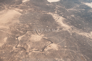
 

De Prorok’s reputation as a public speaker was founded in part on his use of motion pictures taken on his fieldtrips and excavations, a technique then in its infancy. More than that, however, he was a pioneer not just in taking aerial photographs for recording and discovery at and around Carthage, but using a movie camera in the air as well. Whether he was the first to do so in the Middle East and North Africa region is unclear. Some of his film was broadcast from time to time by Pathe as part of its popular cinema News programmes. For example, Pathe Review No. 46 of 1926 included “The Lost Empire of Africa: A camera chronicle of the American excavations at ancient Carthage led by the Count de Prorok”.

Neither the Pathe material nor de Prorok’s own copies - perhaps sold-off or discarded in his last years when he was in serious financial difficulties, seems to have survived.

What he did and was trying to achieve is explained in some detail by de Prorok in his 1926 book, Digging for Lost African Gods (40-41) where he differentiates between films (moving pictures) and photographs (still shots) and introduces he nearly as enigmatic colleague:
We took films of what we were doing. It was the first time that archaeological research had been filmed, and the idea did not meet with very great favour at first. Since then, however, the value of the step has been recognised, and it is a common practise in many universities to-day, to use films for instruction. Our photographer was the young Prince Edgard de Waldeck, who had spent a fortnight of intensive training in Paris, preparatory to this task. 

Later (71-2):
These are the things we talked about on the voyage, because we were all  keyed up by the prospect of a great advance. We talked about what we had done, and what we were going to do. Of all our future plans, perhaps two stood out most vividly
The first was the use of the Aeroplane in archaeology. That venture, as an experiment, materialized three years ago [1922], and since then we have continued, year by year, our prospecting from the air.
In 1922, we took our first films and photographs from different heights, which resulted in our being able to trace the great submerged walls of ancient Carthage. Flying above the Gulf of Tunis, we were able to film clearly six miles of submerged wall, showing constructions a hundred and fifty yards from the present shore. I can still remember the interest with which the news was received by the Royal Geographical Society, when I lectured to them on the subject in London.
… Our use of the aeroplane this year is to be more varied. At the moment we are using it to film the whole coast line, especially at a spot where we have located a sunken galley a stupendous find, of which I shall say more later and at the legendary island of Djerba, where we have located a city under the sea

And later still (181):
            The sea has also made a great deal of change on all this peninsula, but it is very difficult to ascertain at what period it encroached on the land. From the splendid film taken from the air by the late Prince deWaldeck, who was killed on his way back from Carthage this June, it is possible to perceive constructions as much as 100 yards out to sea.
This film is a unique documentation in archaeology, it being the first attempt to film submarine ruins and record their position. The film and photographs were taken at a height of 1500 feet and again at 400 feet, and are superior to any record we could have made on the sea surface. One can trace not only the ancient sea-wall, which in parts is at a depth of 30 feet, but one can study the topography of the peninsula to an extraordinary extent. The bed of the Mejerda is clearly outlined, the wall of Theodosius can be followed approximately, and even the Roman allotments are defined. Soundings off Carthage were undertaken in 1898 by M. de Roquefeuil, but only in that portion of the coast where Roman Carthage was built, that is between La Goulette and Cap Carthage.
That there was a port at La Marsa is certain from the film (“el Mersa” means a port). The constructions we perceived underwater are of vast dimensions, and stretch from Cap Carthage north-east to Cap Kamart; but those at Cap Kamart have not been marked on any map. There appears to have been a great port here, recalling that of Alexandria, with an opening, and breakwater at right angles to the present village of La Marsa. There was a port here in Arab days, but the jetty was certainly earlier, either Roman or Punic. We have followed these walls in a small boat as far as Cap Kamart in continuous zigzag lines. From the aeroplane we could distinguish another line farther out at sea at a depth of about 30 feet, but it is difficult to ascertain, until our final soundings are completed, whether this was a part of the first constructions. The authorities of the French Oceanographic Museum at Carthage will charter a special ship to make soundings along the coast to verify the measurements of these constructions for future investigation.
Cicero mentions a fact that historians of Carthage seem entirely to neglect, that the city “which Scipio destroyed was surrounded with ports.” From the air one can easily get an idea where ports may have been, in the Sebkha of Sukhra (Salina of the Ancients), at La Marsa, and lastly in the Lake of Tunis (Stagnum of the Ancients). We also photographed from the air the sunken galley found in 1908 by sponge divers, from which a rich spoil of marbles and bronzes has been recovered for the Museum of Bardo. We hope to examine the Gulf of Tunis this winter on the chance of finding traces of other ancient ships, five hundred of which were known to have perished during the Punic wars.

Long before the publication of this book – re-issued in 2004 with a lengthy biographical essay on de Prorok by Michael Tarabulski, de Prorok had published several articles, gone on an extensive lecture tour (including in 1923 as Norton Memorial Lecturer of the Archaeological Institute of America) and a lecture to The Royal Geographical Society in London on 27 November 1923 on his excavations (published in The Geographical Journal 63.3 (March): 177-187). The last is important, providing further references to his flying and filming and the statement that the lecture was “illustrated with kinematograph films taken by the late Prince de Waldeck” and one photograph of “The exacavation of Thuburbo Majus” captioned as “Enlarged from kinematograph film by the Prince de Waldeck”.
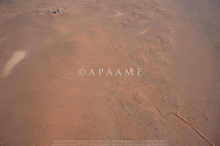
Michael Tarabulski has generously shared his 3+ decades in pursuit of de Prorok including his aerial photographs and aerial movie films. Despite the role of digitization in revealing the contents of old archives, nothing has so far emerged from this flying in Tunisia. No further success has attended a Spanish researcher whose articles have appeared just recently (Garcia Sanchez 2014 and 2016). Nevertheless it seems unlikely all copies of all of these early aerial movie films are lost.

‘Count’ Byron Khun de Proprok is a fascinating character. Even some of those who were most critical of his conduct found him personally charming. Plainly audiences were enchanted – perhaps in part because the tall, handsome and self-confident young man sometimes chose to present himself in pith helmet and fieldwork jodhpurs. His lectures regularly merited reports in The New York Times. Whatever his standing as an archaeologist – mere self-publicising tomb-raider, given to grand-standing perhaps, he was swift not only to apply the very new technique of aerial reconnaissance and photography (at least 3 years before Poidebard commenced his pioneering aerial reconnaissance in Syria) but to take it further with motion pictures which could exploit a growing public taste for cinema and raise awareness of archaeological research.

Many thanks to Michael Tarabulski for generously sharing so much of his research and a detailed correspondence.

Reading:
Garciá Sánchez, J. (2014) “Las excavaciones del conde Byron Khun de Prorok en Cartago (1920-1925): la colina de Juno y la difusión cinematográfica de la arqueología cartaginesa/ The Excavations of Count Byron Khun de Prorok in Carthage (1920-1925): The Hill ofJuno and the Cinematographic Dissemination of Carthaginian Archaeology”, Boletín del Seminario de Estudios de Arte y Arqueología80: 129-163
Garciá Sánchez, J. (2016) “Regreso a la tumba de Tin Hinan: nuevas fuentes en torno a lasexcavaciones de Byron Khun de Prorok en Abalessa (Ahaggar,Argelia)/ Tin Hinan’s Tomb revisited: new sources relating to the ByronKhun de Prorok’s excavation in Abalessa (Ahaggar, Algeria)”, Cuadernos de Prehistoria y Arqueología Universidad Autónoma de Madrid (CuPAUAM) 42: 187-208
Khun de Prorok, Comte Byron (1924) “Recent researches on the Peninsula of Carthage”, The Geographical Journal 63.3 (March): 177-187
Khun de Prorok, Comte Byron (1926) Digging for Lost African Gods. The Record of Five Years Archaeological Excavation in North Africa, New York and London (Putnam)
Tarabulski, M. (1989) “Recording the past: capturing the history of archaeology on videotape”, in A. L. Christenson (ed.) Tracing Archaeology's Past: The Historiography of Archaeology, Carbondale (Southern Illinois University Press): 179-186
Tarabulski, M. (2004) “The life and death of Byron Khun de Prorok”, in B.Khun de Prorok, Digging for Lost African Gods. Five YearsArchaeological Excavation in North Africa, Santa Barbara (TheNarrative Press) 251-267.

Of interest are the recent fictionalised account of de Prorok:
Turmel. W. (2015) The Count of the Sahara, London (The Book Folks)
… and an nterview with the author on 18 November 2015


Winged Crisaders and RAF's 14 Squadron in Jordan

$
0
0
I corresponded with the author several years ago and he kindly sent drafts of a couple of chapters covering 1915 to 1945 but I then missed that he had published the book. Now available in hard copy or as Kindle download. No 14 was the sole RAF squadron in Transjordan between the wars and carried out several programmes of aerial photography.

Napier, M. (2013) Winged Crusaders: The Exploits of 14 Squadron RFC & RAF 1915-45, London (Pen & Sword Books Ltd)


1937 Aerial Photos of ‘Pre-State Israel’

$
0
0

The 5th March 2017 edition of Haaretz carries a feature about the publisher Zalman Schocken and the unusual gift he had put together for some friends –  albums of 40 aerial views of places in what was then the British Mandate of Palestine. Previously almost all such photography was the preserve of the military – beginning with those taken for Gustav Dalman by the German air force in Palestine and adjacent areas during the First World War. Several copies now reside in the National Library of Israel
Atlit Castle

An Unexpected Commemoration of the Tapline

$
0
0


A regular sight while flying over the Harret al-Shaam in Jordan is the ruler-straight line of the road running alongside the long-defunct Trans-Arabian Pipeline which carried fuel from Saudi Arabia to Sidon in Lebanon from 1950 till – for its section into Jordan, 1990.   

As the photo shows, the Tapline road and pipe often cut through ancient structures - in this case it is Ausaji Kite 31.
An unexpected reminder can be found in New York where the High Line Walkway/ Park – a 1.45 mile disused elevated section of an old railway line in west-central Manhattan, includes open-air art.
 

In this case it is a series of engraved rings welded to the old rail lines, each commemorating a section of the Tapline.

Viewing all 125 articles
Browse latest View live