The 2014 AAJ flying season is well and truly behind us,
the photograph cataloguing completed, and we can now start to really look and analyse what we have captured.
We have often been asked “When will the Aerial Archaeology in Jordan project be finished?”. Despite flying annually in Jordan since 1997, AAJ is far from finished; it is a long-term programme and unique in the region. It has been a series of voyages of discovery as we find new sites every year and we record changes in the landscape, as well as working with other archaeologists in the region, who request aerial reconnaissance over their site or area.
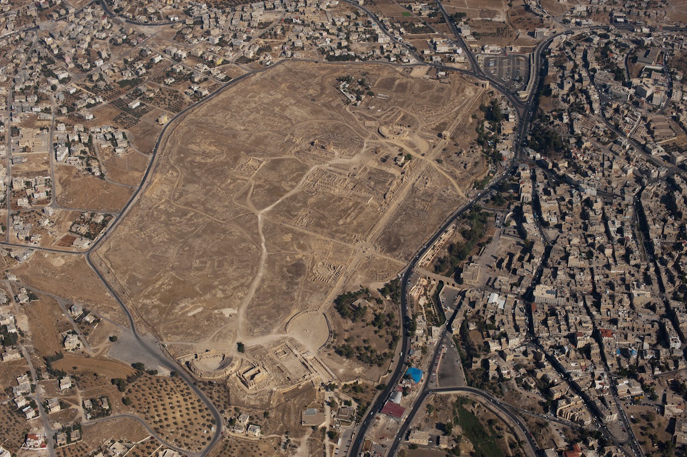
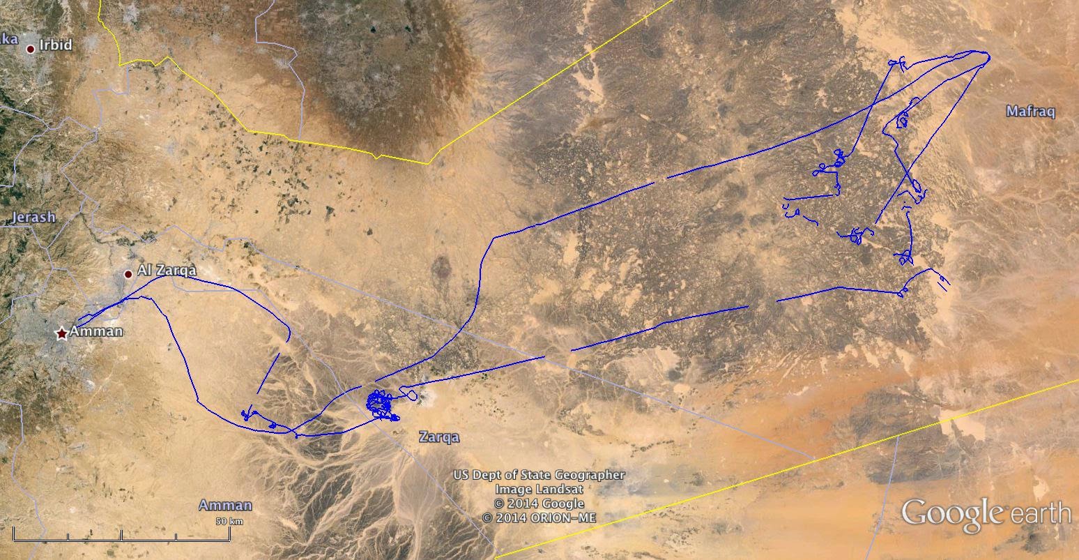
In 2014 we covered a huge area of Jordan, north-south, east-west (limited only by the range of the helicopter or the borders of neighbouring countries).
Our flights are usually predetermined by a list of sites that we have identified (partially thanks to the input of many colleagues working in Jordan) as needing new photography or that have not been photographed before. Flying between these sites we often catch glimpses of other sites, and occasionally these turn out to be something new too! We do an initial check of these ‘new’ sites against historical maps (such as the K737 series 1:50,000 maps) and the
MEGA-Jordan database to try and identify the sites. Occasionally, a new site for us appears to be a new discovery-
such as the possible Roman Column Quarry from Flight 20141013, which is always exciting and is just the start of a process of investigation and research.
Here is a taste of what is new in our database from this year’s flying:
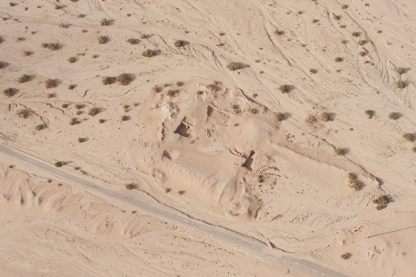
Two sites near Zarqa we couldn’t believe we hadn’t photographed before were
Jneneh and Kh. al-Batrawy.
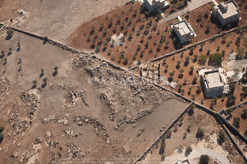
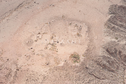
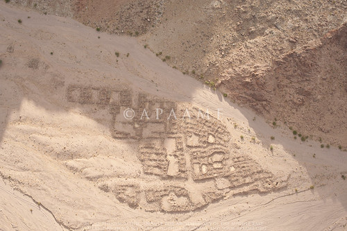
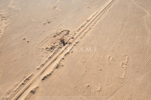
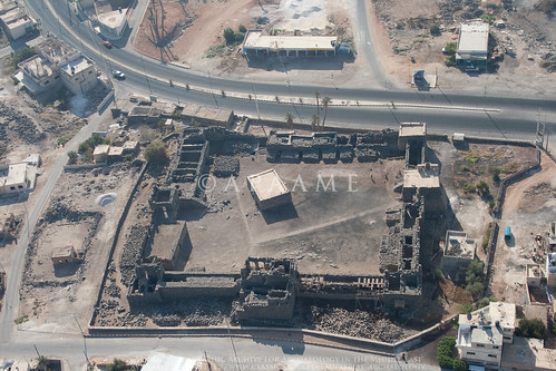
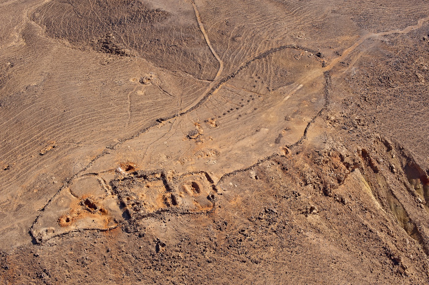
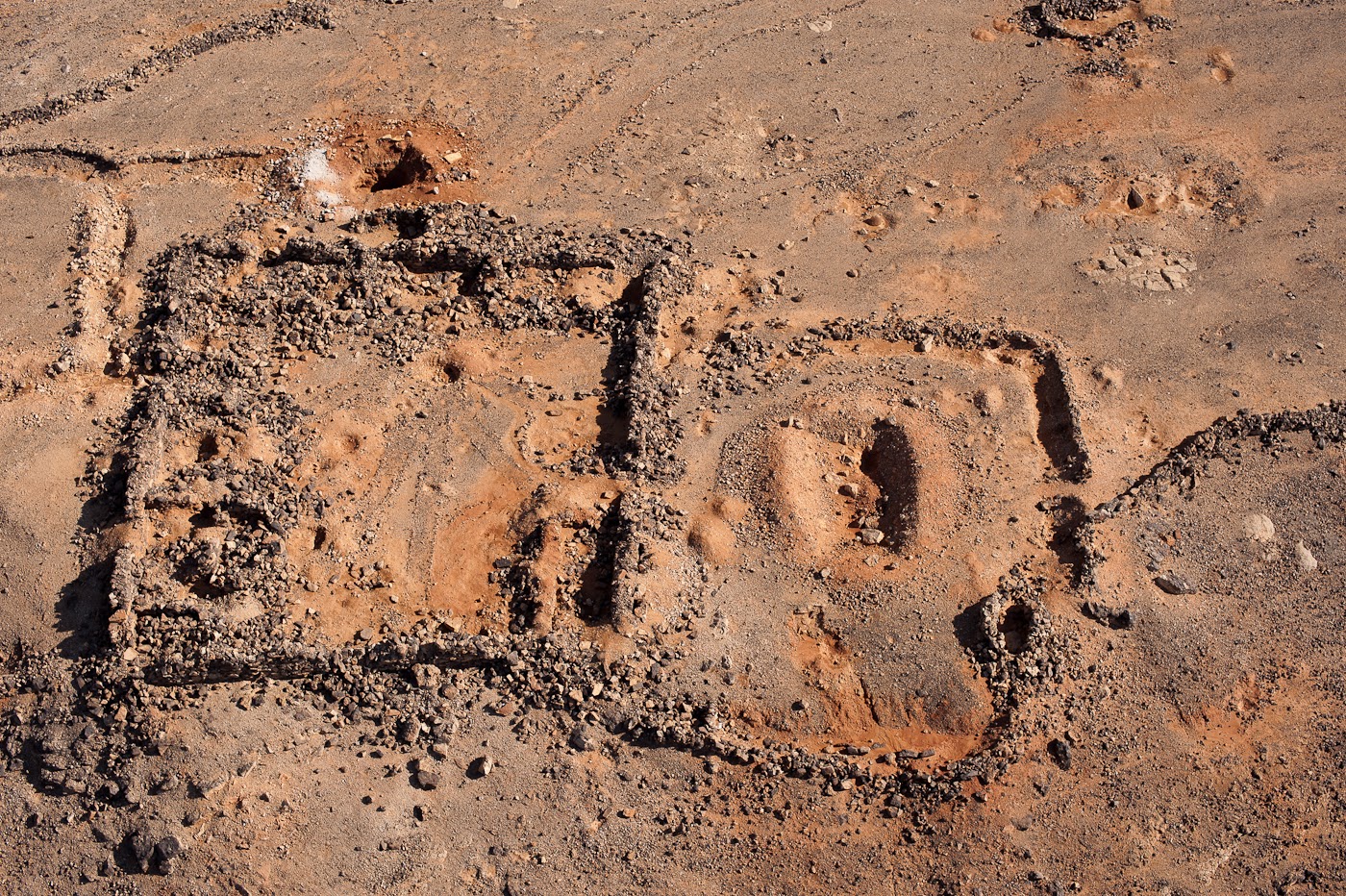
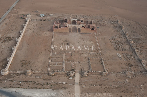
![Khirbet al-Batrawy]() |
| Khirbet al-Batrawy - © APAAME_20141012_RHB-0034. Photographer: Robert Bewley. |
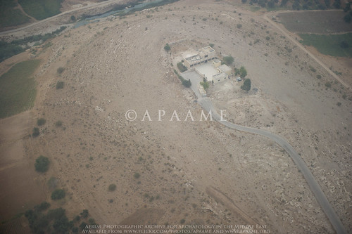
Udhma, north of Amman, has half been destroyed by modern development.
![Udhma]() |
| Udhma - © APAAME_20141012_MND-0096. Photographer: Matthew Dalton. |
Tells of the Jordan Valley –
Tell el Qos,
Ammata,
Hammeh, and
Tall Abu ez Zeighan, also, new excavations at Tell el-Hammam.
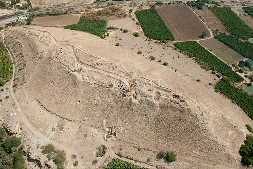
![Tell el-Hammam; Kafrein Trenches 2]() |
| Tell el-Hammam - © APAAME_20141028_DLK-0365. Photographer: David Kennedy. |
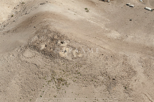
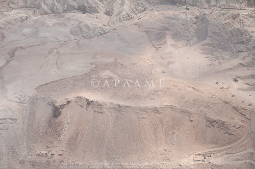
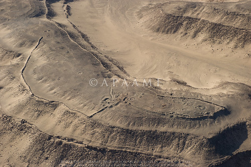
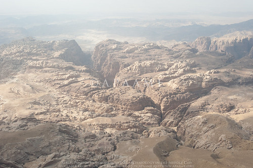
Nearby up the wadi from the Kafrein Dam is the site of Suwwan.
![Suwwan]() |
| Suwwan - ©APAAME_20141028_DLK-0386. Photographer: David Kennedy. |
Sometimes sites can be overlooked because of their vicinity to a ‘big name’ site, but we do not want to be guilty of this mistake. Sites in the vicinity of
Machaerus–
Ataruz,
Aruda,
Khirbat ed Deir and
El-Quraiyat, and
Umm er-Resas–
Umm er-Resas Ruin 1and 2, were additions this year.
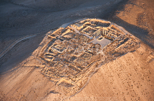
![Ataruz (Attarus)]() |
| Ataruz - © APAAME_20141013_REB-0051. Photographer: Rebecca Banks. |
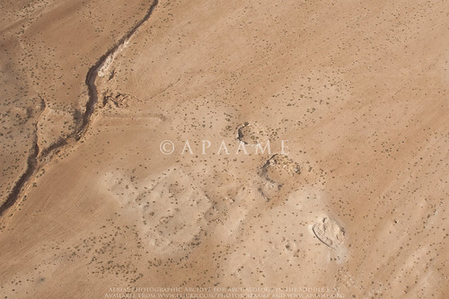
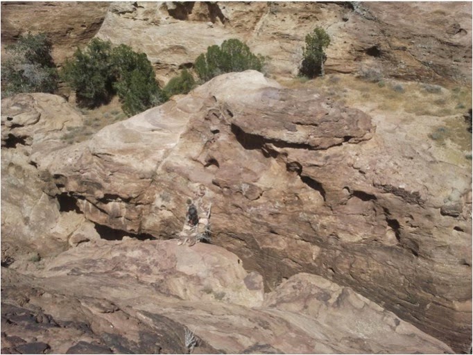
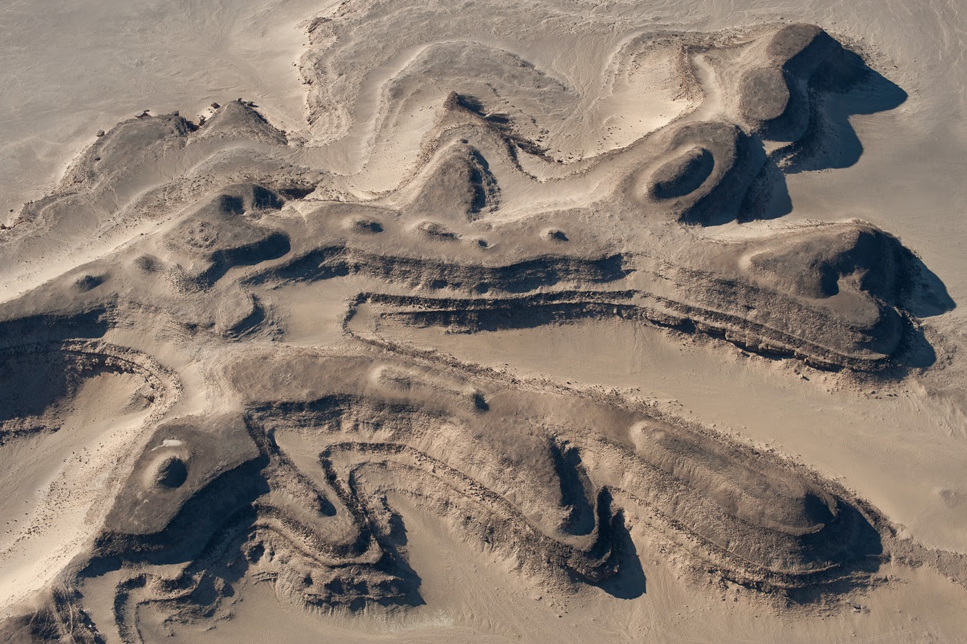
A rare foray to the Southern Dead Sea Basin captured many sites previously not photographed by us. A highlight included the Wadi Hamarash excavations suggested to us by Prof. Adamantios Sampson, not least because of what an interesting squeeze it was for the Helicopter in the Wadi valley.
![Wadi Hamarash Neolithic Site (Site 1)]() |
| Wadi Hamarash Neolithic Site (Site 1) - © APAAME_20141013_REB-0286. Photographer: Rebecca Banks. |
Mtakalash ar-Rababa, an interesting site which was snapped just in passing.
![Mtakalash ar-Rababa]() |
| Mtakalash ar-Rababa - © APAAME_20141013_MND-0507. Photographer: Matthew Dalton. |
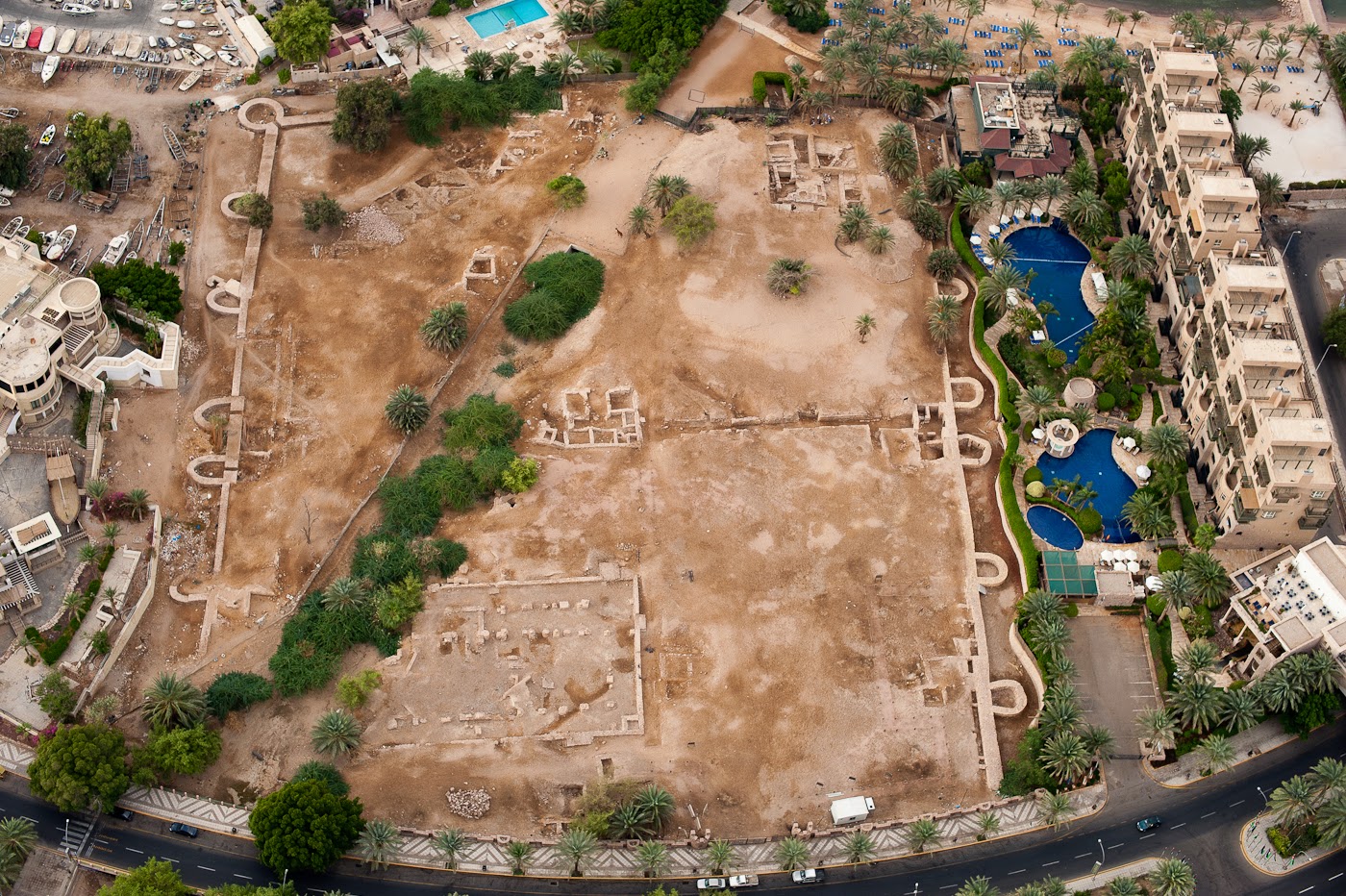
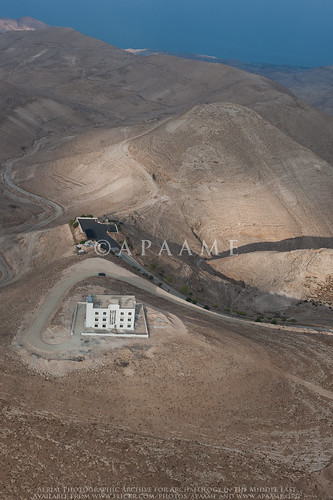
We also photographed the shelter for Deir Ain Abata being erected over the site.
![Deir Ain Abata]() |
| Deir Ain Abata - © APAAME_20141013_REB-0333. Photographer: Rebecca Banks. |
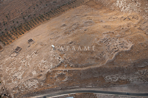
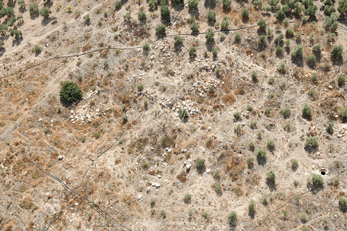
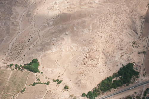
Flying to and from Marka Airport in Amman over the fertile hinterland is always a busy time with sites numerous and close together- sites are often just photographed ‘in passing’. This year the keen eyes of Mat spied what appears to be a possible Tomb (
Amman Tomb 5), and a large concentration of rubble underneath an olive plantation that is likely a settlement or village of some description (Amman Village? 1). Neither site is recorded in
MEGA-Jordan or on the K737 maps, but the village is clearly visible on Hunting Aerial Survey photographs of 1953 taken before the olive grove existed. A revisit on the 6th and last flight has confirmed both sites are indeed of interest.
![Amman Village? 1]() |
| Building rubble and cistern evident at site 'Amman Village? 1'. © APAAME_20141028_DLK-0282. Photographer: David Kennedy. |
Our flight to Aqaba was a very productive two days as we rarely get to fly so far south. Despite delays and difficulties caused by the weather many sites were photographed for the first time, some highlights included:
Kh. Titn sites recommended to us by Kristoffer Damgaard.
![Kh. Titn 2 (Large Cluster)]() |
| Kh. Titn 2 (Large Cluster) - © APAAME_20141020_RHB-0069. Photographer: Robert Bewley. |
The keen eyes of Don Boyer through poor visibility alerted us to the existence of Mlehleb.
![Mlehleb]() |
| Mlehleb - © APAAME_20141019_DDB-0006. Photographer: Don Boyer. |
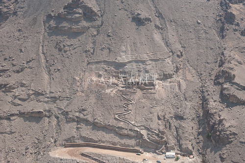
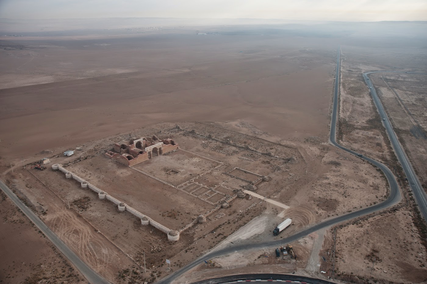
The amazing fort ‘
Aina Fort 1’, (
edit: thank you to Haim Ben David for information regarding this site - it is identified as el-Medeiyneh by Glueck (1935, 104-1-6, 181)) and a smaller fort ‘Tafila Fortlet 1’.
![Tafila Fortlet? 1]() |
| 'Tafila Fortlet? 1' - © APAAME_20141019_DDB-0244. Photographer: Don Boyer. |
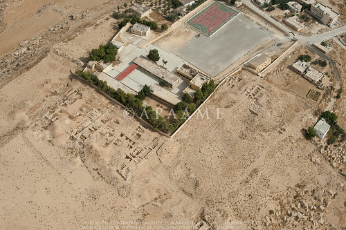
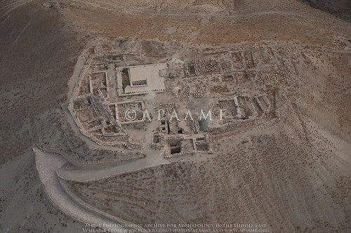
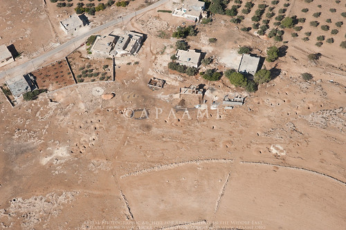
The ancient site underneath the modern town of Buseira (Busayra) suggested to us by a University of California, Berkeley, team.
![Buseira]() |
| Buseira (Busayra) - © APAAME_20141019_RHB-0256. Photographer: Robert Bewley. |
Railway enthusiasts should enjoy this year's flying along the southern portion of the Hedjaz Railway in Jordan.
![Mahattat er-Ramla]() |
| Mahattat er-Ramla on the Hedjaz Railway. © APAAME_20141020_DLK-0221. Photographer: David Kennedy. |
Particularly striking were the Ottoman defensive structures positioned at strategic points along its length.
![Mudawwara Northern Redoubt]() |
| Mudawwarra Northern Redoubt - © APAAME_20141020_DDB-0164. Photographer: Don Boyer. |
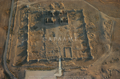
A treat for Romanist David Kennedy was the
Roman Fort at Gharandal, and the long stretch of the Via Nova Traiana investigated (see blog -
The Via Nova Traiana in Central Jordan), but also the unexpected traces of Roman Roads photographed in passing.
![Umm er-Resas Roman Road 1]() |
| A stretch of possible Roman Road near Umm er-Resas. © APAAME_20141013_MND-0244. Photographer: Matthew Dalton. |
Research into the site of Muwaqqar by David Kennedy led us to investigate possible sites ‘
Sahab Ruin 9and 10’ located nearby which were identified from satellite imagery. Neither site is recorded in
MEGA-Jordan or on older maps to our knowledge, but the photographs show they are possibly substantive sites.
![Sahab Ruin 10]() |
| 'Sahab Ruin 10' - © APAAME_20141028_TPH-0125. Photographer: Travis Hearn. |
These photographs are a record of these sites, but also a starting point or addition to the research into the many periods of history, heritage and archaeology in Jordan. Please feel free to leave comments on the Flickr image pages regarding site identification and information.
We owe a debt of gratitude to so many but without our funders, especially The Packard Humanities Institute and the Seven Pillars of Wisdom Trust, we would not be able to continue. We are very grateful to our hosts the Council for British Research in the Levant (CBRL) in Amman, and especially Nadja. The Royal Jordanian Air Force and their superb pilots ‘make it happen’ and could not be more helpful, hospitable and safe. David, Bob, Becc, Mat, Travis and Don all made this an exceptional year and we hope for many more.
You can find all of the 2014 Flying Season photographs on our
Flickr '2014 Flights' collection page: https://www.flickr.com/photos/apaame/collections/72157646490200724/


.jpg)

.jpg)
.jpg)
.jpg)